Vercors 3
- 91.3 km
- 2,566 m
- 2,568 m
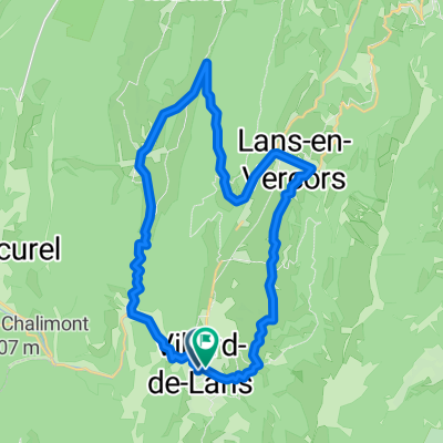
- Villard-de-Lans, Auvergne-Rhône-Alpes, France
A cycling route starting in Villard-de-Lans, Auvergne-Rhône-Alpes, France.
Overview
over the Col de Herbouilly largely in the forest
then through the lovely high valley on the D103 to the tunnel entrance
descend through the Vernaison gorge to the unique Pont-en-Royans.
return always slightly uphill through the impressive Bourne gorge.
created this 8 years ago
Route quality
Road
21.2 km
(32 %)
Quiet road
2.6 km
(4 %)
Paved
62.8 km
(95 %)
Asphalt
62.8 km
(95 %)
Undefined
3.3 km
(5 %)
Continue with Bikemap
You would like to ride Vernaison + Bourne - Schluchten - Runde or customize it for your own trip? Here is what you can do with this Bikemap route:
Free trial for 3 days, or one-time payment. More about Bikemap Premium.
Discover more Premium features.
Get Bikemap PremiumFrom our community
Open it in the app