

über die Hohe Buche (Waldhessen)
A cycling route starting in Breitenbach, Hesse, Germany.
Overview
About this route
gentle inclines, more for warming up or rolling out.
- -:--
- Duration
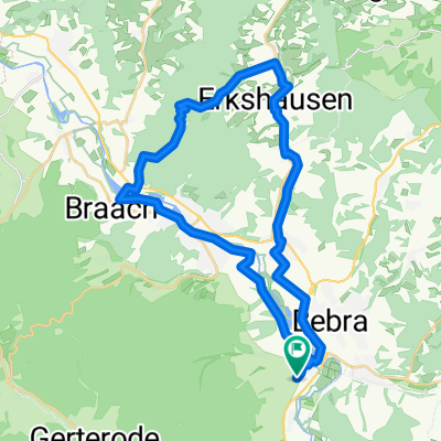
- 32.4 km
- Distance
- 334 m
- Ascent
- 334 m
- Descent
- ---
- Avg. speed
- ---
- Max. altitude

Continue with Bikemap
Use, edit, or download this cycling route
You would like to ride über die Hohe Buche (Waldhessen) or customize it for your own trip? Here is what you can do with this Bikemap route:
Free features
- Save this route as favorite or in collections
- Copy & plan your own version of this route
- Sync your route with Garmin or Wahoo
Premium features
Free trial for 3 days, or one-time payment. More about Bikemap Premium.
- Navigate this route on iOS & Android
- Export a GPX / KML file of this route
- Create your custom printout (try it for free)
- Download this route for offline navigation
Discover more Premium features.
Get Bikemap PremiumFrom our community
Other popular routes starting in Breitenbach
 6 Buchen
- Distance
- 28.6 km
- Ascent
- 451 m
- Descent
- 448 m
- Location
- Breitenbach, Hesse, Germany
 Von Breitenbach in die Rhön
- Distance
- 79.2 km
- Ascent
- 424 m
- Descent
- 424 m
- Location
- Breitenbach, Hesse, Germany
 Bad Hersfeld auf neuen Wegen
- Distance
- 67.4 km
- Ascent
- 618 m
- Descent
- 612 m
- Location
- Breitenbach, Hesse, Germany
 1. Etappe Breitenbach -Oberhof
- Distance
- 114.1 km
- Ascent
- 1,469 m
- Descent
- 1,027 m
- Location
- Breitenbach, Hesse, Germany
 R1 Breitenbach - Graue Katze
- Distance
- 79.5 km
- Ascent
- 444 m
- Descent
- 499 m
- Location
- Breitenbach, Hesse, Germany
 breitenbach-kleinensee-mecklar
- Distance
- 61.2 km
- Ascent
- 567 m
- Descent
- 565 m
- Location
- Breitenbach, Hesse, Germany
 Über den Alheimer
- Distance
- 33.1 km
- Ascent
- 484 m
- Descent
- 485 m
- Location
- Breitenbach, Hesse, Germany
 Friedewaldtour 2019
- Distance
- 37.5 km
- Ascent
- 376 m
- Descent
- 375 m
- Location
- Breitenbach, Hesse, Germany
Open it in the app