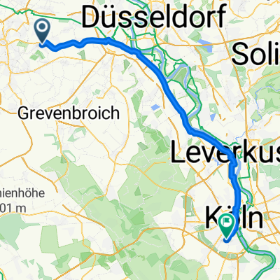
An der Blankstraße, Korschenbroich nach Gottesweg, Köln
- 57.8 km
- 94 m
- 85 m
- Korschenbroich, North Rhine-Westphalia, Germany
A cycling route starting in Korschenbroich, North Rhine-Westphalia, Germany.
Overview
Unterhalb von Mönchegladbach-Rheydt über die Felder nach Odenkirchen. Dann gemütlich Richtung Arsbek und Vlodrop, NL. Bei Maasbracht über die Autobahnbrücke und weiter nach Kinroi, und den Kanal dahinter. Der westliche Kanal ist der Richtige ;-) Dieser Kanal führt wunderbar ruhig bis Herentals, ab da wird´s industrieller. 60 km sind es dann noch bis zum Ziel. Ab Wijnegem über die Schleuse (etwas abenteuerlich) den Kanal überqueren und hinter sich lassen und dann links runter über die langestreckte Stichstrasse bis zum Stadtpark Rivierenhof. Hier kann man herrlich ruhig in die Stadt abkürzen und rollen lassen.
created this 8 years ago
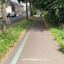
Route quality
Access road
56.7 km
(33 %)
Quiet road
44.7 km
(26 %)
Paved
99.7 km
(58 %)
Unpaved
10.3 km
(6 %)
Asphalt
94.5 km
(55 %)
Gravel
6.9 km
(4 %)
Continue with Bikemap
You would like to ride Glehn - ANT 170er or customize it for your own trip? Here is what you can do with this Bikemap route:
Free trial for 3 days, or one-time payment. More about Bikemap Premium.
Discover more Premium features.
Get Bikemap PremiumFrom our community
Open it in the app