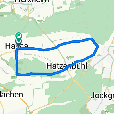
- 51.4 km
- 543 m
- 543 m
- Hatzenbühl, Rhineland-Palatinate, Germany
Tabaktour
A cycling route starting in Hatzenbühl, Rhineland-Palatinate, Germany.
Overview
About this route
The tour is easy to ride and ideal for families, there are hardly any inclines. The route mainly follows agricultural paths, partly paved, partly concrete and alongside cycle paths. Before Mörlheim, a low-traffic road must be crossed. There is an unpaved path between Herxheimweyher and Herxheim (about 1 km).
- -:--
- Duration
- 32.9 km
- Distance
- 75 m
- Ascent
- 80 m
- Descent
- ---
- Avg. speed
- 151 m
- Max. altitude
created this 18 years ago
Route quality
Waytypes & surfaces along the route
Waytypes
Track
15.5 km
(47 %)
Quiet road
7.2 km
(22 %)
Surfaces
Paved
28.9 km
(88 %)
Unpaved
2 km
(6 %)
Asphalt
22.4 km
(68 %)
Concrete
6.2 km
(19 %)
Route highlights
Points of interest along the route
Point of interest after 0.7 km
Tabakschuppen zum Trocknen des Tabaks
Point of interest after 0.7 km
Point of interest after 5.7 km
Wagner-Ranch Essen und Trinken Mo. Ruhetag
Point of interest after 28 km
Tabakwiegehalle
Point of interest after 30.2 km
Tabakbrunnen (Dorfbrunnen) Dieser Brunnenplatz im Ortskern wurde als Zentrum der Kommunikation und als Stätte der Begegnung konzipiert. Die bildhauerischen Elemente charakterisieren die Gemeinde: Tabaksstaude-Motorrad-Einhorn- Brotkorb-Pferd. Gestaltet von dem Künstler Gernot Rumpf
Point of interest after 30.2 km
Point of interest after 30.7 km
Rennbahn, Motor- und Reitsport
Point of interest after 32.7 km
Point of interest after 32.7 km
Tabakbrunnen in Hayna Gestaltet von dem Künstler Gernot Rumpf
Continue with Bikemap
Use, edit, or download this cycling route
You would like to ride Tabaktour or customize it for your own trip? Here is what you can do with this Bikemap route:
Free features
- Save this route as favorite or in collections
- Copy & plan your own version of this route
- Sync your route with Garmin or Wahoo
Premium features
Free trial for 3 days, or one-time payment. More about Bikemap Premium.
- Navigate this route on iOS & Android
- Export a GPX / KML file of this route
- Create your custom printout (try it for free)
- Download this route for offline navigation
Discover more Premium features.
Get Bikemap PremiumFrom our community
Other popular routes starting in Hatzenbühl
- Landeck und Madenburg ab Hayna
- Herxheim Bei Landau/Pfalz nach Herxheim bei Landau/Pfalz
- 61.6 km
- 396 m
- 401 m
- Hatzenbühl, Rhineland-Palatinate, Germany
- von Zuhause nach Steinweiler
- 7.8 km
- 28 m
- 25 m
- Hatzenbühl, Rhineland-Palatinate, Germany
- Radrunde durch Herxheim bei Landau/Pfalz
- 13.2 km
- 51 m
- 51 m
- Hatzenbühl, Rhineland-Palatinate, Germany
- Tabaktour
- 32.9 km
- 75 m
- 80 m
- Hatzenbühl, Rhineland-Palatinate, Germany
- Route von Hauptstraße 74, Herxheim bei Landau/Pfalz
- 63.2 km
- 173 m
- 178 m
- Hatzenbühl, Rhineland-Palatinate, Germany
- Hayna nach Rülzheim Mohn
- 10.2 km
- 42 m
- 52 m
- Hatzenbühl, Rhineland-Palatinate, Germany
- 2015 Hatzenbühl Zeiskam Hatzenbühl
- 51.4 km
- 110 m
- 111 m
- Hatzenbühl, Rhineland-Palatinate, Germany
Open it in the app


