

Francigena Monteriggioni-Siena variante mista piedi-bici
A cycling route starting in Belverde, Tuscany, Italy.
Overview
About this route
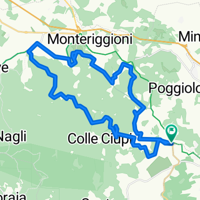
Lasciato Monteriggioni si attraversa la Cassia e si prende la strada del Gallinaio. In corrispondenza di az. agraria si prende a sx Strada dell'Uccellatoio. Ad una biforcazione si tiene la sx, poi poco prima di arrivare sulla Cassia si va a dx pe r Casa vecchia, Casa Bucci, La Villa. All'incrocio con via del Lago si va a sx , poi subito a dx fino ad incrociare SP di Montemaggio. Si prende a dx e dopo circa 1 km a sx in direzione di Strada delle Coste, Petriccio fino ad arrivare a Siena su via Fiorentina presso Ostello Guidoriccio
- -:--
- Duration
- 16.7 km
- Distance
- 269 m
- Ascent
- 200 m
- Descent
- ---
- Avg. speed
- ---
- Max. altitude
Route quality
Waytypes & surfaces along the route
Waytypes
Track
7.9 km
(47 %)
Quiet road
4.4 km
(26 %)
Surfaces
Paved
5.4 km
(32 %)
Unpaved
9.9 km
(59 %)
Asphalt
5.4 km
(32 %)
Ground
4.7 km
(28 %)
Continue with Bikemap
Use, edit, or download this cycling route
You would like to ride Francigena Monteriggioni-Siena variante mista piedi-bici or customize it for your own trip? Here is what you can do with this Bikemap route:
Free features
- Save this route as favorite or in collections
- Copy & plan your own version of this route
- Sync your route with Garmin or Wahoo
Premium features
Free trial for 3 days, or one-time payment. More about Bikemap Premium.
- Navigate this route on iOS & Android
- Export a GPX / KML file of this route
- Create your custom printout (try it for free)
- Download this route for offline navigation
Discover more Premium features.
Get Bikemap PremiumFrom our community
Other popular routes starting in Belverde
 belri-monteriggioni-castellare
- Distance
- 38.2 km
- Ascent
- 677 m
- Descent
- 677 m
- Location
- Belverde, Tuscany, Italy
 Ceppo-AbbadiaIsola-Colleciupi-Ceppo
- Distance
- 24.7 km
- Ascent
- 513 m
- Descent
- 513 m
- Location
- Belverde, Tuscany, Italy
 2008-05-22 Siena / Babarino val d´Elsa
- Distance
- 40.5 km
- Ascent
- 781 m
- Descent
- 827 m
- Location
- Belverde, Tuscany, Italy
 mappa 1 da scorgiano 586
- Distance
- 37 km
- Ascent
- 795 m
- Descent
- 825 m
- Location
- Belverde, Tuscany, Italy
 Siena-Quercegrossa-Castellina-Radda-Lo Smorto-Molin Lungo-Pianella-Siena
- Distance
- 66.3 km
- Ascent
- 711 m
- Descent
- 711 m
- Location
- Belverde, Tuscany, Italy
 siena-san gimignano-siena
- Distance
- 121.9 km
- Ascent
- 1,433 m
- Descent
- 1,433 m
- Location
- Belverde, Tuscany, Italy
 dal bosco alla riviera
- Distance
- 24.5 km
- Ascent
- 535 m
- Descent
- 535 m
- Location
- Belverde, Tuscany, Italy
 montagnola
- Distance
- 37 km
- Ascent
- 694 m
- Descent
- 698 m
- Location
- Belverde, Tuscany, Italy
Open it in the app