

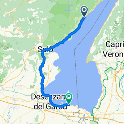
Gargnano Stausee
A cycling route starting in Gargnano, Lombardy, Italy.
Overview
About this route
- -:--
- Duration
- 25.6 km
- Distance
- 196 m
- Ascent
- 579 m
- Descent
- ---
- Avg. speed
- ---
- Max. altitude

Continue with Bikemap
Use, edit, or download this cycling route
You would like to ride Gargnano Stausee or customize it for your own trip? Here is what you can do with this Bikemap route:
Free features
- Save this route as favorite or in collections
- Copy & plan your own version of this route
- Sync your route with Garmin or Wahoo
Premium features
Free trial for 3 days, or one-time payment. More about Bikemap Premium.
- Navigate this route on iOS & Android
- Export a GPX / KML file of this route
- Create your custom printout (try it for free)
- Download this route for offline navigation
Discover more Premium features.
Get Bikemap PremiumFrom our community
Other popular routes starting in Gargnano
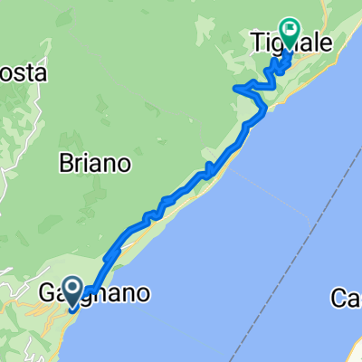
 Anello Val Vestino e lago D'idro
- Distance
- 82.5 km
- Ascent
- 1,055 m
- Descent
- 1,049 m
- Location
- Gargnano, Lombardy, Italy
 Navazzo-Prabione
- Distance
- 16.5 km
- Ascent
- 659 m
- Descent
- 622 m
- Location
- Gargnano, Lombardy, Italy
 Sasso Riva Ledro Idro Sasso
- Distance
- 133.2 km
- Ascent
- 2,359 m
- Descent
- 2,368 m
- Location
- Gargnano, Lombardy, Italy
 Via Crocefisso, Gargnano to Piazza Virgilio, Sirmione
- Distance
- 44.9 km
- Ascent
- 594 m
- Descent
- 638 m
- Location
- Gargnano, Lombardy, Italy
 briano
- Distance
- 15.9 km
- Ascent
- 994 m
- Descent
- 12 m
- Location
- Gargnano, Lombardy, Italy
 Garda 2011 4.den
- Distance
- 41.9 km
- Ascent
- 1,179 m
- Descent
- 1,179 m
- Location
- Gargnano, Lombardy, Italy
 Da Via Angelo Feltrinelli a Via Roma Gardola
- Distance
- 13 km
- Ascent
- 1,175 m
- Descent
- 737 m
- Location
- Gargnano, Lombardy, Italy
 ITALIEN GARGANO
- Distance
- 41.9 km
- Ascent
- 1,093 m
- Descent
- 1,090 m
- Location
- Gargnano, Lombardy, Italy
Open it in the app