

Unstrut-Wanderweg_SH_EF
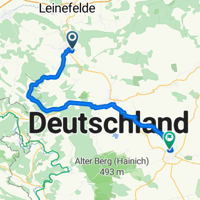
A cycling route starting in Silberhausen, Thuringia, Germany.
Overview
About this route
- -:--
- Duration
- 83.6 km
- Distance
- 122 m
- Ascent
- 253 m
- Descent
- ---
- Avg. speed
- ---
- Max. altitude

Route quality
Waytypes & surfaces along the route
Waytypes
Track
24.2 km
(29 %)
Quiet road
15.9 km
(19 %)
Surfaces
Paved
67.7 km
(81 %)
Unpaved
7.5 km
(9 %)
Asphalt
66.1 km
(79 %)
Gravel
7.5 km
(9 %)
Continue with Bikemap
Use, edit, or download this cycling route
You would like to ride Unstrut-Wanderweg_SH_EF or customize it for your own trip? Here is what you can do with this Bikemap route:
Free features
- Save this route as favorite or in collections
- Copy & plan your own version of this route
- Split it into stages to create a multi-day tour
- Sync your route with Garmin or Wahoo
Premium features
Free trial for 3 days, or one-time payment. More about Bikemap Premium.
- Navigate this route on iOS & Android
- Export a GPX / KML file of this route
- Create your custom printout (try it for free)
- Download this route for offline navigation
Discover more Premium features.
Get Bikemap PremiumFrom our community
Other popular routes starting in Silberhausen
 Dingelstädt - Kloster Anrode
- Distance
- 25.6 km
- Ascent
- 275 m
- Descent
- 288 m
- Location
- Silberhausen, Thuringia, Germany
 Johann-Sebastian-Bach-Straße 10, Silberhausen nach Göttinger Straße 18, Heilbad Heiligenstadt
- Distance
- 19.7 km
- Ascent
- 225 m
- Descent
- 287 m
- Location
- Silberhausen, Thuringia, Germany
 holztalleben
- Distance
- 58.1 km
- Ascent
- 347 m
- Descent
- 474 m
- Location
- Silberhausen, Thuringia, Germany
 kanonenbahn
- Distance
- 59.8 km
- Ascent
- 447 m
- Descent
- 578 m
- Location
- Silberhausen, Thuringia, Germany
 Unstrutradweg 09-2019
- Distance
- 168 km
- Ascent
- 433 m
- Descent
- 655 m
- Location
- Silberhausen, Thuringia, Germany
 Unstrut-Wanderweg_SH_EF
- Distance
- 83.6 km
- Ascent
- 122 m
- Descent
- 253 m
- Location
- Silberhausen, Thuringia, Germany
 Unstrutradweg Teil 1
- Distance
- 84.5 km
- Ascent
- 264 m
- Descent
- 443 m
- Location
- Silberhausen, Thuringia, Germany
 Dingelstädt nach Geschwister-Scholl-Straße 13, Dingelstädt
- Distance
- 33.1 km
- Ascent
- 458 m
- Descent
- 455 m
- Location
- Silberhausen, Thuringia, Germany
Open it in the app