francigenaS.Quirico d'Orcia-Radicofani-Acquapendente
- 66.9 km
- 1,155 m
- 1,182 m
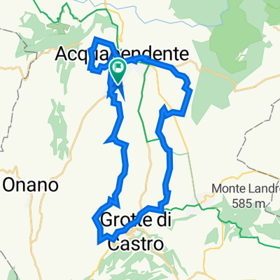
- Acquapendente, Lazio, Italy
A cycling route starting in Acquapendente, Lazio, Italy.
Overview
Si scende a Vignoni su sterrato. Dopo la visita del borgo alto si scende a Bagno Vignoni. Si scende ancora per immettersi a dx sulla SP23, che si lascia do po circa 1 km. Presso il podere San Pietro si prende su sterrato a sx, si rientra un attimo sulla SP"£, poi di nuovo su sterrato a sx che in quasi 9 km ci riporta sulla Cassia, vicino al borgo di Galliana. (Volendo si può percorrere tutta la Cassi, soprattutto in caso di tempaccio). Si percorre 1.5 km e si devia a dx sulla SP 13 per Campiglia d'Orcia e, fatti pochi metri, si prende a sx sulla vecchia Cassia dismessa. Dopo circa 4 km si torna sulla Cassia e dopo circa 1 km si va a dx sulla SP478 direzione Radicofani. Si attraversa il paese, ski percorrono alcuni metri ancora sulla SP478, si prende la SP 24 e al 1° tornante si va diritti su sterrata in discesa che, in 9 km, ci porta a Ponte a Rigo. Si va a dx sulla Cassia e poi a sx sulla SP20. Dopo circa 4 km si devia a sx su sterrato che si percorre per circa 5 km, di nuovo secondaria asfaltata fino a Proceno. Si prosegue sulla SP 52 fino a raggiungere la Cassia, ma pochi metri prima si prende a dx su str. secondaria che ci condurrà ad Acquapendente.
created this 8 years ago
Route quality
Quiet road
31.4 km
(47 %)
Track
12 km
(18 %)
Paved
30.8 km
(46 %)
Unpaved
26.1 km
(39 %)
Asphalt
30.8 km
(46 %)
Gravel
12 km
(18 %)
Continue with Bikemap
You would like to ride francigenaS.Quirico d'Orcia-Radicofani-Acquapendente or customize it for your own trip? Here is what you can do with this Bikemap route:
Free trial for 3 days, or one-time payment. More about Bikemap Premium.
Discover more Premium features.
Get Bikemap PremiumFrom our community
Open it in the app