

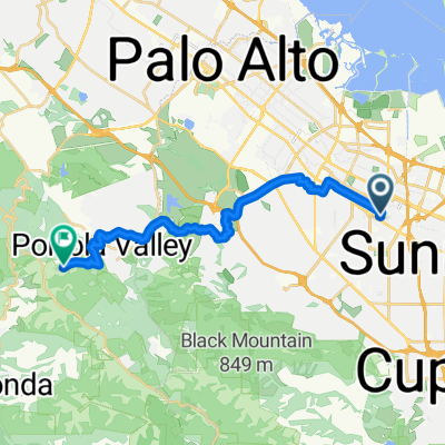
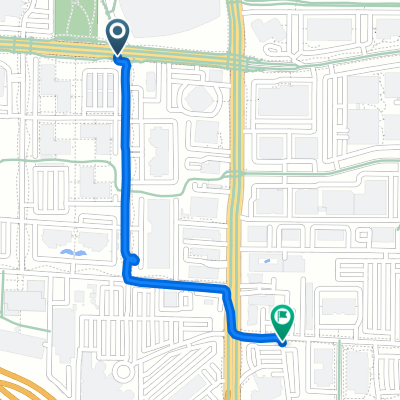
Foothill Expressway
A cycling route starting in Mountain View, California, United States.
Overview
About this route
- 46 min
- Duration
- 9.5 km
- Distance
- 74 m
- Ascent
- 80 m
- Descent
- 12.4 km/h
- Avg. speed
- ---
- Max. altitude

Route quality
Waytypes & surfaces along the route
Waytypes
Road
3.7 km
(39 %)
Cycleway
1.4 km
(15 %)
Surfaces
Paved
5.7 km
(60 %)
Asphalt
3.9 km
(41 %)
Paved (undefined)
1.8 km
(19 %)
Undefined
3.8 km
(40 %)
Continue with Bikemap
Use, edit, or download this cycling route
You would like to ride Foothill Expressway or customize it for your own trip? Here is what you can do with this Bikemap route:
Free features
- Save this route as favorite or in collections
- Copy & plan your own version of this route
- Sync your route with Garmin or Wahoo
Premium features
Free trial for 3 days, or one-time payment. More about Bikemap Premium.
- Navigate this route on iOS & Android
- Export a GPX / KML file of this route
- Create your custom printout (try it for free)
- Download this route for offline navigation
Discover more Premium features.
Get Bikemap PremiumFrom our community
Other popular routes starting in Mountain View
 Fairmont Ave, Mountain View to Spring Ridge Trail, Portola Valley
- Distance
- 21.9 km
- Ascent
- 632 m
- Descent
- 232 m
- Location
- Mountain View, California, United States
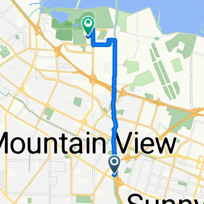
 Nicholas Dr, Mountain View to Nicholas Dr, Mountain View
- Distance
- 21 km
- Ascent
- 70 m
- Descent
- 69 m
- Location
- Mountain View, California, United States
 E El Camino Real, Mountain View to Charleston Rd, Mountain View
- Distance
- 7.7 km
- Ascent
- 4 m
- Descent
- 45 m
- Location
- Mountain View, California, United States
 Nicholas Dr, Mountain View to Nicholas Dr, Mountain View
- Distance
- 20.9 km
- Ascent
- 43 m
- Descent
- 44 m
- Location
- Mountain View, California, United States
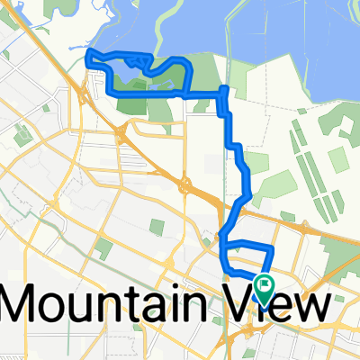
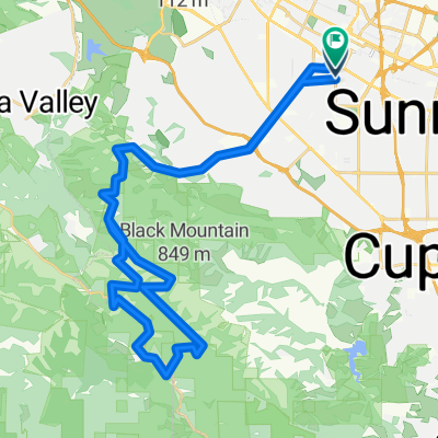
 Tied House - Los Altos Hill Loop (Long)
- Distance
- 45.1 km
- Ascent
- 420 m
- Descent
- 418 m
- Location
- Mountain View, California, United States
 Nicholas Dr, Mountain View to Nicholas Dr, Mountain View
- Distance
- 21.9 km
- Ascent
- 67 m
- Descent
- 81 m
- Location
- Mountain View, California, United States
 Joaquin Rd, マウンテンビューへN Shoreline Blvd, マウンテンビュー
- Distance
- 1.3 km
- Ascent
- 4 m
- Descent
- 0 m
- Location
- Mountain View, California, United States
 Sept 27 route
- Distance
- 53.9 km
- Ascent
- 1,790 m
- Descent
- 1,790 m
- Location
- Mountain View, California, United States
Open it in the app