

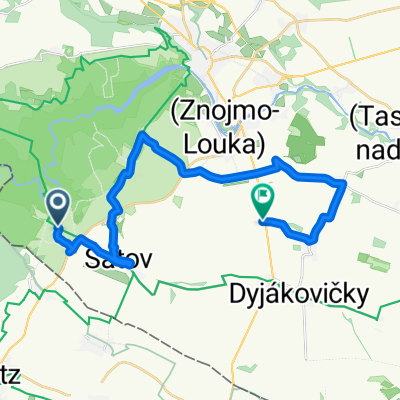
Hardegg-Falkenstein
A cycling route starting in Šatov, South Moravian, Czechia.
Overview
About this route
- -:--
- Duration
- 74.5 km
- Distance
- 479 m
- Ascent
- 491 m
- Descent
- ---
- Avg. speed
- ---
- Max. altitude

Route quality
Waytypes & surfaces along the route
Waytypes
Quiet road
23.8 km
(32 %)
Track
22.3 km
(30 %)
Surfaces
Paved
43.9 km
(59 %)
Unpaved
3 km
(4 %)
Asphalt
40.2 km
(54 %)
Paved (undefined)
3.7 km
(5 %)
Continue with Bikemap
Use, edit, or download this cycling route
You would like to ride Hardegg-Falkenstein or customize it for your own trip? Here is what you can do with this Bikemap route:
Free features
- Save this route as favorite or in collections
- Copy & plan your own version of this route
- Sync your route with Garmin or Wahoo
Premium features
Free trial for 3 days, or one-time payment. More about Bikemap Premium.
- Navigate this route on iOS & Android
- Export a GPX / KML file of this route
- Create your custom printout (try it for free)
- Download this route for offline navigation
Discover more Premium features.
Get Bikemap PremiumFrom our community
Other popular routes starting in Šatov
 1397/36
- Distance
- 44.5 km
- Ascent
- 458 m
- Descent
- 458 m
- Location
- Šatov, South Moravian, Czechia
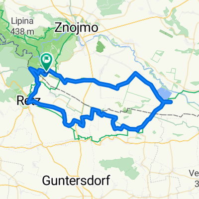
 Hardegg - Falkenstein (Kamp-Thaya-March 3)
- Distance
- 76.6 km
- Ascent
- 465 m
- Descent
- 469 m
- Location
- Šatov, South Moravian, Czechia
 Znojmo Wine
- Distance
- 22.3 km
- Ascent
- 165 m
- Descent
- 246 m
- Location
- Šatov, South Moravian, Czechia
 KUKA TOUR 2014 - 1. etapa
- Distance
- 77.9 km
- Ascent
- 758 m
- Descent
- 753 m
- Location
- Šatov, South Moravian, Czechia
 Objezd ČR IV
- Distance
- 231.9 km
- Ascent
- 1,502 m
- Descent
- 1,079 m
- Location
- Šatov, South Moravian, Czechia
 Hotel Happy Star - Znojmo --HHS okruh
- Distance
- 38.7 km
- Ascent
- 445 m
- Descent
- 444 m
- Location
- Šatov, South Moravian, Czechia
 KUKA TOUR 2014 - 2. etapa
- Distance
- 77 km
- Ascent
- 222 m
- Descent
- 306 m
- Location
- Šatov, South Moravian, Czechia
 Hnanice - Retz - Jaroslavice -Hnanice - 68km
- Distance
- 68.8 km
- Ascent
- 478 m
- Descent
- 480 m
- Location
- Šatov, South Moravian, Czechia
Open it in the app