

giethoorn
A cycling route starting in Wanneperveen, Overijssel, The Netherlands.
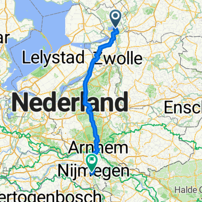
Overview
About this route
waterland route
- -:--
- Duration
- 38.1 km
- Distance
- 0 m
- Ascent
- 0 m
- Descent
- ---
- Avg. speed
- ---
- Max. altitude

Route quality
Waytypes & surfaces along the route
Waytypes
Road
14.5 km
(38 %)
Quiet road
12.2 km
(32 %)
Surfaces
Paved
32 km
(84 %)
Asphalt
21.4 km
(56 %)
Concrete
10.7 km
(28 %)
Undefined
6.1 km
(16 %)
Continue with Bikemap
Use, edit, or download this cycling route
You would like to ride giethoorn or customize it for your own trip? Here is what you can do with this Bikemap route:
Free features
- Save this route as favorite or in collections
- Copy & plan your own version of this route
- Sync your route with Garmin or Wahoo
Premium features
Free trial for 3 days, or one-time payment. More about Bikemap Premium.
- Navigate this route on iOS & Android
- Export a GPX / KML file of this route
- Create your custom printout (try it for free)
- Download this route for offline navigation
Discover more Premium features.
Get Bikemap PremiumFrom our community
Other popular routes starting in Wanneperveen
 Giethoorn - Zwolle
- Distance
- 32.1 km
- Ascent
- 9 m
- Descent
- 5 m
- Location
- Wanneperveen, Overijssel, The Netherlands
 TT Nijeveen (2,5 uur)
- Distance
- 97.7 km
- Ascent
- 0 m
- Descent
- 0 m
- Location
- Wanneperveen, Overijssel, The Netherlands
 giethoorn
- Distance
- 38.1 km
- Ascent
- 0 m
- Descent
- 0 m
- Location
- Wanneperveen, Overijssel, The Netherlands
 Terug
Terug- Distance
- 123.5 km
- Ascent
- 167 m
- Descent
- 154 m
- Location
- Wanneperveen, Overijssel, The Netherlands
 Veneweg 193, Wanneperveen to Veneweg 193, Wanneperveen
- Distance
- 35.9 km
- Ascent
- 23 m
- Descent
- 20 m
- Location
- Wanneperveen, Overijssel, The Netherlands
 Start Winneperveen, Giethoorn, lange route
- Distance
- 40.8 km
- Ascent
- 4 m
- Descent
- 4 m
- Location
- Wanneperveen, Overijssel, The Netherlands
 Giethorn, 1+2
- Distance
- 54.5 km
- Ascent
- 5 m
- Descent
- 4 m
- Location
- Wanneperveen, Overijssel, The Netherlands
 dag 13 weerribben garderen
- Distance
- 85.9 km
- Ascent
- 151 m
- Descent
- 112 m
- Location
- Wanneperveen, Overijssel, The Netherlands
Open it in the app