

Hanoi-Hochiminh City via HCM Highway
A cycling route starting in Hanoi, Hanoi, Vietnam.
Overview
About this route
- -:--
- Duration
- 1,822.1 km
- Distance
- 4,416 m
- Ascent
- 4,414 m
- Descent
- ---
- Avg. speed
- ---
- Max. altitude

Continue with Bikemap
Use, edit, or download this cycling route
You would like to ride Hanoi-Hochiminh City via HCM Highway or customize it for your own trip? Here is what you can do with this Bikemap route:
Free features
- Save this route as favorite or in collections
- Copy & plan your own version of this route
- Split it into stages to create a multi-day tour
- Sync your route with Garmin or Wahoo
Premium features
Free trial for 3 days, or one-time payment. More about Bikemap Premium.
- Navigate this route on iOS & Android
- Export a GPX / KML file of this route
- Create your custom printout (try it for free)
- Download this route for offline navigation
Discover more Premium features.
Get Bikemap PremiumFrom our community
Other popular routes starting in Hanoi
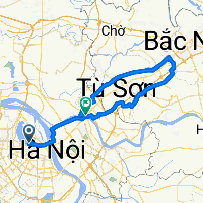 HAN-Bac Ninh 00
- Distance
- 51.8 km
- Ascent
- 19 m
- Descent
- 22 m
- Location
- Hanoi, Hanoi, Vietnam
 Vietnam to Koh Chang
- Distance
- 2,533.1 km
- Ascent
- 2,297 m
- Descent
- 2,253 m
- Location
- Hanoi, Hanoi, Vietnam
 Hanoi-Hochiminh City via HCM Highway
- Distance
- 1,822.1 km
- Ascent
- 4,416 m
- Descent
- 4,414 m
- Location
- Hanoi, Hanoi, Vietnam
 Trần Phú, Hà Nội to 35 Trần Phú, Hà Nội
- Distance
- 21.4 km
- Ascent
- 76 m
- Descent
- 78 m
- Location
- Hanoi, Hanoi, Vietnam
 thế dục
- Distance
- 5.8 km
- Ascent
- 400 m
- Descent
- 386 m
- Location
- Hanoi, Hanoi, Vietnam
 Trần Phú, Hà Nội to 35 Trần Phú, Hà Nội
- Distance
- 21.4 km
- Ascent
- 84 m
- Descent
- 83 m
- Location
- Hanoi, Hanoi, Vietnam
 12月練習
12月練習- Distance
- 53 km
- Ascent
- 67 m
- Descent
- 64 m
- Location
- Hanoi, Hanoi, Vietnam
 Vong trong Ho Tay
- Distance
- 14.1 km
- Ascent
- 61 m
- Descent
- 59 m
- Location
- Hanoi, Hanoi, Vietnam
Open it in the app