

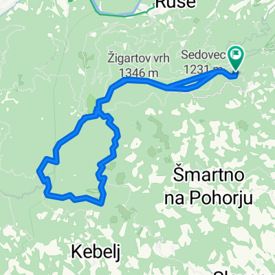
Nočni pohod
A cycling route starting in Ruše, Občina Ruše, Slovenia.
Overview
About this route
- -:--
- Duration
- 5.1 km
- Distance
- 285 m
- Ascent
- 288 m
- Descent
- ---
- Avg. speed
- ---
- Avg. speed

Continue with Bikemap
Use, edit, or download this cycling route
You would like to ride Nočni pohod or customize it for your own trip? Here is what you can do with this Bikemap route:
Free features
- Save this route as favorite or in collections
- Copy & plan your own version of this route
- Sync your route with Garmin or Wahoo
Premium features
Free trial for 3 days, or one-time payment. More about Bikemap Premium.
- Navigate this route on iOS & Android
- Export a GPX / KML file of this route
- Create your custom printout (try it for free)
- Download this route for offline navigation
Discover more Premium features.
Get Bikemap PremiumFrom our community
Other popular routes starting in Ruše
 Od Ruševca okrog Črnega jezera in Treh Kraljev
- Distance
- 41.9 km
- Ascent
- 814 m
- Descent
- 814 m
- Location
- Ruše, Občina Ruše, Slovenia
 Areh-Rogla-Areh
- Distance
- 48.8 km
- Ascent
- 1,078 m
- Descent
- 1,088 m
- Location
- Ruše, Občina Ruše, Slovenia
 Lobniška riža tura s ŠD Pulz
- Distance
- 32.2 km
- Ascent
- 881 m
- Descent
- 881 m
- Location
- Ruše, Občina Ruše, Slovenia
 Ruše Šumik Klopni vrh Pesek Lovrenc Ruše
- Distance
- 51.7 km
- Ascent
- 1,269 m
- Descent
- 1,268 m
- Location
- Ruše, Občina Ruše, Slovenia
 Od Ruševca okrog Črnega jezera in Treh Kraljev
- Distance
- 45.4 km
- Ascent
- 837 m
- Descent
- 900 m
- Location
- Ruše, Občina Ruše, Slovenia
 Areh-Šumik-Klopni vrh-Pesek
- Distance
- 23.6 km
- Ascent
- 483 m
- Descent
- 351 m
- Location
- Ruše, Občina Ruše, Slovenia
 Nočni pohod
- Distance
- 5.1 km
- Ascent
- 285 m
- Descent
- 288 m
- Location
- Ruše, Občina Ruše, Slovenia
 Areh - Lovrenška jezera
- Distance
- 54.5 km
- Ascent
- 951 m
- Descent
- 941 m
- Location
- Ruše, Občina Ruše, Slovenia
Open it in the app