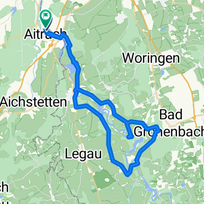
33 "-hofen"-Tour
A cycling route starting in Aitrach, Baden-Württemberg, Germany.
Overview
About this route
Abwechslungsreiche Tour durch die "-hofen" rings um Leutkirch im Allgäu.
- -:--
- Duration
- 81.6 km
- Distance
- 431 m
- Ascent
- 431 m
- Descent
- ---
- Avg. speed
- ---
- Max. altitude
Route quality
Waytypes & surfaces along the route
Waytypes
Road
41 km
(50 %)
Quiet road
28.2 km
(35 %)
Surfaces
Paved
34.3 km
(42 %)
Unpaved
0.1 km
(<1 %)
Asphalt
27.7 km
(34 %)
Paved (undefined)
6.6 km
(8 %)
Continue with Bikemap
Use, edit, or download this cycling route
You would like to ride 33 "-hofen"-Tour or customize it for your own trip? Here is what you can do with this Bikemap route:
Free features
- Save this route as favorite or in collections
- Copy & plan your own version of this route
- Split it into stages to create a multi-day tour
- Sync your route with Garmin or Wahoo
Premium features
Free trial for 3 days, or one-time payment. More about Bikemap Premium.
- Navigate this route on iOS & Android
- Export a GPX / KML file of this route
- Create your custom printout (try it for free)
- Download this route for offline navigation
Discover more Premium features.
Get Bikemap PremiumFrom our community
Other popular routes starting in Aitrach
- Radreise zum Bodensee: 5. Tag – Von Aitrach nach Lindau
- Distance
- 71.4 km
- Ascent
- 366 m
- Descent
- 556 m
- Location
- Aitrach, Baden-Württemberg, Germany
- Aitrach - Alcazar
- Distance
- 57.2 km
- Ascent
- 332 m
- Descent
- 332 m
- Location
- Aitrach, Baden-Württemberg, Germany
- Kronburg - Feierabendrunde mit Biergarten
- Distance
- 24.2 km
- Ascent
- 204 m
- Descent
- 205 m
- Location
- Aitrach, Baden-Württemberg, Germany
- BW-12 Etappe 12 - Marstetten Aitrach - Ulm
- Distance
- 68 km
- Ascent
- 91 m
- Descent
- 215 m
- Location
- Aitrach, Baden-Württemberg, Germany
- Illertal - Rothtal - Günztal - Runde
- Distance
- 90.8 km
- Ascent
- 232 m
- Descent
- 233 m
- Location
- Aitrach, Baden-Württemberg, Germany
- 33 "-hofen"-Tour
- Distance
- 81.6 km
- Ascent
- 431 m
- Descent
- 431 m
- Location
- Aitrach, Baden-Württemberg, Germany
- Aitrach - Diepoldshofen - Seibranz - Rot/Rot - Aitrach
- Distance
- 55 km
- Ascent
- 306 m
- Descent
- 303 m
- Location
- Aitrach, Baden-Württemberg, Germany
- Sonntagsrunde ab Volkratshofen
- Distance
- 51.2 km
- Ascent
- 442 m
- Descent
- 442 m
- Location
- Aitrach, Baden-Württemberg, Germany
Open it in the app