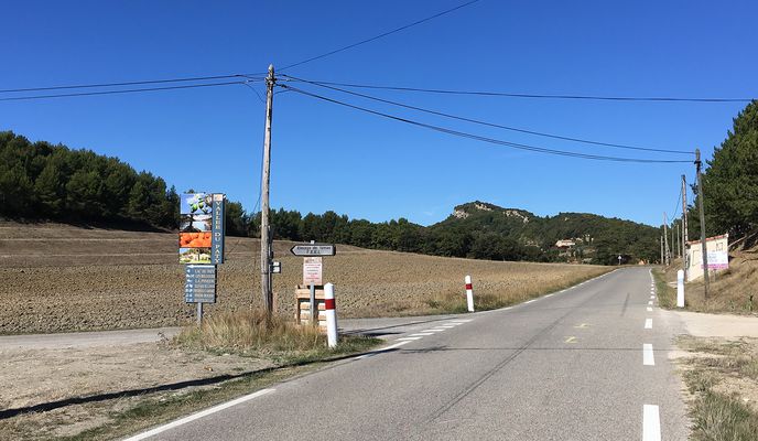
Bedoin-Garomb
A cycling route starting in Bédoin, Provence-Alpes-Côte d'Azur Region, France.
Overview
About this route
Von Bedoin aus leichte bis mittlere Steigung Richtung Col de la Madeleine. Nach ca. 5 km erreicht man den ersten Aussichtspunkt. Nach dem Col folgt die kurze Talfahrt bis in eine Talsenke. Dort die Abzweigung links in die kleine Nebenstrasse nicht verpassen. Weiter gehts bis auf die Anhöhe nach demLac du Paty. Herrliche Aussicht! Danach steile und kurvenreiche Abfahrt bis vor Caromb. Im Dorf muss man sich den Weg suchen: Beim Dorfbrunnen links hinunter, danach wieder links und dann die erste nach rechts. Auf der Nebenstrasse gehts nach und nach steiler bis Crillon-le-Brave. Zuletzt Strasse bis Bedoin.
- -:--
- Duration
- 21.4 km
- Distance
- 374 m
- Ascent
- 374 m
- Descent
- ---
- Avg. speed
- ---
- Max. altitude
Route photos
Route quality
Waytypes & surfaces along the route
Waytypes
Busy road
8.7 km
(41 %)
Quiet road
8.4 km
(39 %)
Surfaces
Paved
19.3 km
(90 %)
Asphalt
19.1 km
(89 %)
Concrete
0.2 km
(<1 %)
Undefined
2.1 km
(10 %)
Continue with Bikemap
Use, edit, or download this cycling route
You would like to ride Bedoin-Garomb or customize it for your own trip? Here is what you can do with this Bikemap route:
Free features
- Save this route as favorite or in collections
- Copy & plan your own version of this route
- Sync your route with Garmin or Wahoo
Premium features
Free trial for 3 days, or one-time payment. More about Bikemap Premium.
- Navigate this route on iOS & Android
- Export a GPX / KML file of this route
- Create your custom printout (try it for free)
- Download this route for offline navigation
Discover more Premium features.
Get Bikemap PremiumFrom our community
Other popular routes starting in Bédoin
 Bedoin-Col de Madaleine-Lac du Paty-Caromb-Crillon-Bedoin
- Distance
- 22.7 km
- Ascent
- 358 m
- Descent
- 360 m
- Location
- Bédoin, Provence-Alpes-Côte d'Azur Region, France
 Bedoin Dentelles de Montmirail Bedaoin
- Distance
- 52.1 km
- Ascent
- 1,090 m
- Descent
- 1,110 m
- Location
- Bédoin, Provence-Alpes-Côte d'Azur Region, France
 Villes sur Auzon-La Gabelle-La Nesque-Villes sur Auzon
- Distance
- 47.1 km
- Ascent
- 1,958 m
- Descent
- 1,959 m
- Location
- Villes-sur-Auzon, Provence-Alpes-Côte d'Azur Region, France
 Ventoux - Enduro Face nord
- Distance
- 23.6 km
- Ascent
- 13 m
- Descent
- 1,584 m
- Location
- Bédoin, Provence-Alpes-Côte d'Azur Region, France
 Bedoin-Malaucene-Suzette-LaFare-Caromb-Crillon-Bedoin
- Distance
- 43.4 km
- Ascent
- 726 m
- Descent
- 726 m
- Location
- Bédoin, Provence-Alpes-Côte d'Azur Region, France
 Bedoin-Garomb
- Distance
- 21.4 km
- Ascent
- 374 m
- Descent
- 374 m
- Location
- Bédoin, Provence-Alpes-Côte d'Azur Region, France
 Durch die Gorges de la Nesque nach Sault und zurück*
- Distance
- 81.9 km
- Ascent
- 990 m
- Descent
- 961 m
- Location
- Bédoin, Provence-Alpes-Côte d'Azur Region, France
 Belle-Vue - col de la Madeleine
- Distance
- 25.1 km
- Ascent
- 460 m
- Descent
- 517 m
- Location
- Bédoin, Provence-Alpes-Côte d'Azur Region, France
Open it in the app


