

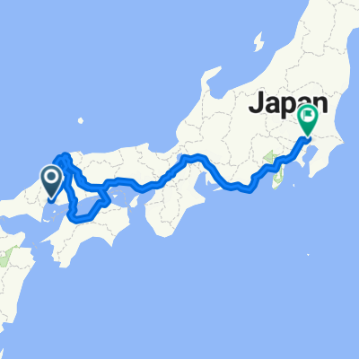
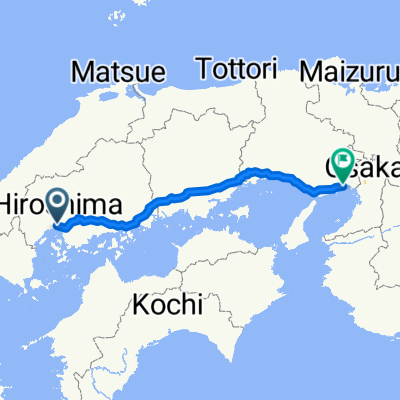
Hiroshima - Fukutsu
A cycling route starting in Hiroshima, Hiroshima, Japan.
Overview
About this route
- -:--
- Duration
- 560.5 km
- Distance
- 2,605 m
- Ascent
- 2,511 m
- Descent
- ---
- Avg. speed
- ---
- Max. altitude

Continue with Bikemap
Use, edit, or download this cycling route
You would like to ride Hiroshima - Fukutsu or customize it for your own trip? Here is what you can do with this Bikemap route:
Free features
- Save this route as favorite or in collections
- Copy & plan your own version of this route
- Split it into stages to create a multi-day tour
- Sync your route with Garmin or Wahoo
Premium features
Free trial for 3 days, or one-time payment. More about Bikemap Premium.
- Navigate this route on iOS & Android
- Export a GPX / KML file of this route
- Create your custom printout (try it for free)
- Download this route for offline navigation
Discover more Premium features.
Get Bikemap PremiumFrom our community
Other popular routes starting in Hiroshima
 From Hiroshima to Saitama
- Distance
- 1,983.3 km
- Ascent
- 37,112 m
- Descent
- 37,104 m
- Location
- Hiroshima, Hiroshima, Japan
 8丁目 まで3丁目
- Distance
- 57 km
- Ascent
- 227 m
- Descent
- 283 m
- Location
- Hiroshima, Hiroshima, Japan
 馬木7丁目, 広島市へ十日市町2丁目, 広島市
- Distance
- 13.1 km
- Ascent
- 126 m
- Descent
- 270 m
- Location
- Hiroshima, Hiroshima, Japan
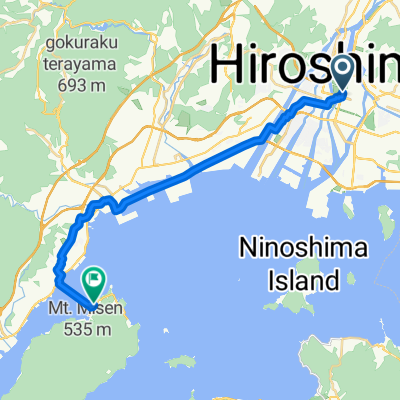 hiroshima to miyajima
- Distance
- 23.1 km
- Ascent
- 98 m
- Descent
- 113 m
- Location
- Hiroshima, Hiroshima, Japan
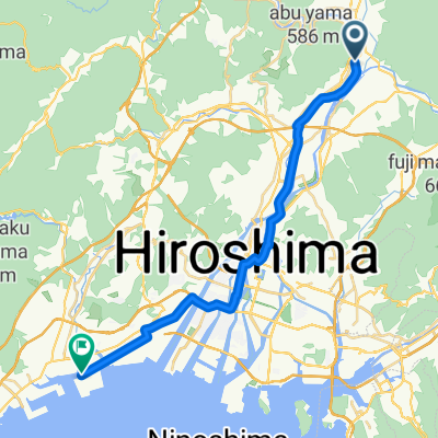
 Hiroshima River Route
- Distance
- 110 km
- Ascent
- 481 m
- Descent
- 480 m
- Location
- Hiroshima, Hiroshima, Japan
 十日市町2丁目, 広島市へ十日市町2丁目, 広島市
- Distance
- 34.1 km
- Ascent
- 559 m
- Descent
- 558 m
- Location
- Hiroshima, Hiroshima, Japan
 No., Hiroshima to Otemachi 4-Chōme, Hiroshima
- Distance
- 10.2 km
- Ascent
- 82 m
- Descent
- 82 m
- Location
- Hiroshima, Hiroshima, Japan
 Hiroshima => Osaka/Amagasaki
- Distance
- 334.6 km
- Ascent
- 837 m
- Descent
- 840 m
- Location
- Hiroshima, Hiroshima, Japan
Open it in the app