
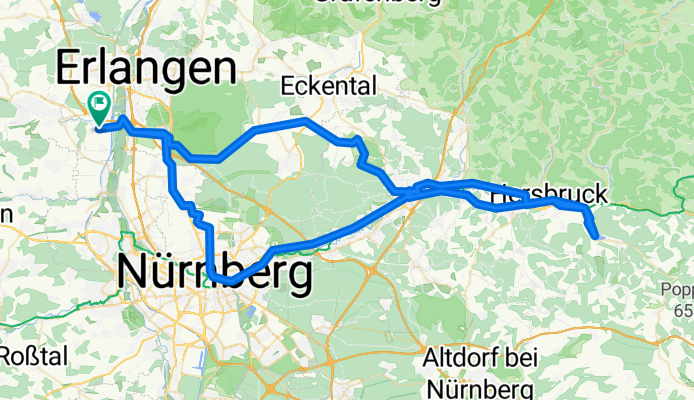
Erlangen-Stausee Happurg und zurück
A cycling route starting in Obermichelbach, Bavaria, Germany.
Overview
About this route
Beautiful day trip primarily along bike paths and quiet roads. Diverse landscape with beautiful viewpoints.
- -:--
- Duration
- 106.9 km
- Distance
- 484 m
- Ascent
- 487 m
- Descent
- ---
- Avg. speed
- 437 m
- Max. altitude
Route quality
Waytypes & surfaces along the route
Waytypes
Path
44.9 km
(42 %)
Quiet road
29.9 km
(28 %)
Surfaces
Paved
89.8 km
(84 %)
Unpaved
6.4 km
(6 %)
Asphalt
86.6 km
(81 %)
Gravel
6.4 km
(6 %)
Continue with Bikemap
Use, edit, or download this cycling route
You would like to ride Erlangen-Stausee Happurg und zurück or customize it for your own trip? Here is what you can do with this Bikemap route:
Free features
- Save this route as favorite or in collections
- Copy & plan your own version of this route
- Split it into stages to create a multi-day tour
- Sync your route with Garmin or Wahoo
Premium features
Free trial for 3 days, or one-time payment. More about Bikemap Premium.
- Navigate this route on iOS & Android
- Export a GPX / KML file of this route
- Create your custom printout (try it for free)
- Download this route for offline navigation
Discover more Premium features.
Get Bikemap PremiumFrom our community
Other popular routes starting in Obermichelbach
 Schöne Feierabendtour westlich von Erlangen
- Distance
- 46.8 km
- Ascent
- 180 m
- Descent
- 195 m
- Location
- Obermichelbach, Bavaria, Germany
 Waldrunde durch Tennenloher Forst
- Distance
- 34.8 km
- Ascent
- 174 m
- Descent
- 174 m
- Location
- Obermichelbach, Bavaria, Germany
 MTB-Runde bis Herzogenaurach
- Distance
- 28.7 km
- Ascent
- 204 m
- Descent
- 205 m
- Location
- Obermichelbach, Bavaria, Germany
 Erlangen-Stausee Happurg und zurück
- Distance
- 106.9 km
- Ascent
- 484 m
- Descent
- 487 m
- Location
- Obermichelbach, Bavaria, Germany
 Obermichelbach - Würzburg
- Distance
- 96.1 km
- Ascent
- 217 m
- Descent
- 362 m
- Location
- Obermichelbach, Bavaria, Germany
 Rennhofen-Linden-Deberndorf
- Distance
- 67.8 km
- Ascent
- 410 m
- Descent
- 411 m
- Location
- Obermichelbach, Bavaria, Germany
 19km Runde
- Distance
- 19 km
- Ascent
- 110 m
- Descent
- 110 m
- Location
- Obermichelbach, Bavaria, Germany
 Rothenberg
- Distance
- 23.2 km
- Ascent
- 125 m
- Descent
- 125 m
- Location
- Obermichelbach, Bavaria, Germany
Open it in the app