
Meran Bike Highline-Teil
A cycling route starting in Plaus, Trentino-Alto Adige, Italy.
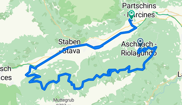
Overview
About this route
Aschbach - Naturnser Alm - Tablander Alm - Marzorner Alm - Castellbell - Naturns - Rabland
- -:--
- Duration
- 55.7 km
- Distance
- 1,086 m
- Ascent
- 1,875 m
- Descent
- ---
- Avg. speed
- ---
- Max. altitude
Continue with Bikemap
Use, edit, or download this cycling route
You would like to ride Meran Bike Highline-Teil or customize it for your own trip? Here is what you can do with this Bikemap route:
Free features
- Save this route as favorite or in collections
- Copy & plan your own version of this route
- Sync your route with Garmin or Wahoo
Premium features
Free trial for 3 days, or one-time payment. More about Bikemap Premium.
- Navigate this route on iOS & Android
- Export a GPX / KML file of this route
- Create your custom printout (try it for free)
- Download this route for offline navigation
Discover more Premium features.
Get Bikemap PremiumFrom our community
Other popular routes starting in Plaus
 Naturns Meran Terlan Lana
- Distance
- 73.5 km
- Ascent
- 474 m
- Descent
- 442 m
- Location
- Plaus, Trentino-Alto Adige, Italy
 I 007: Untervinschgau
- Distance
- 44.1 km
- Ascent
- 433 m
- Descent
- 433 m
- Location
- Plaus, Trentino-Alto Adige, Italy
 Meran Bike Highline-Teil
- Distance
- 55.7 km
- Ascent
- 1,086 m
- Descent
- 1,875 m
- Location
- Plaus, Trentino-Alto Adige, Italy
 Naturns Prad Bormio (Stilfzer Joch)
- Distance
- 127.8 km
- Ascent
- 2,305 m
- Descent
- 2,305 m
- Location
- Plaus, Trentino-Alto Adige, Italy
 Plaus - Schnatzhof Naturns
- Distance
- 11.1 km
- Ascent
- 1,009 m
- Descent
- 170 m
- Location
- Plaus, Trentino-Alto Adige, Italy
 Meringerhof - Seespitz by Bike CLONED FROM ROUTE 315390
- Distance
- 31.8 km
- Ascent
- 1,358 m
- Descent
- 1,369 m
- Location
- Plaus, Trentino-Alto Adige, Italy
 Algund - Aschbach
- Distance
- 14 km
- Ascent
- 38 m
- Descent
- 1,041 m
- Location
- Plaus, Trentino-Alto Adige, Italy
 20221017 b) Aschbach - Marling - Töll
- Distance
- 24.4 km
- Ascent
- 603 m
- Descent
- 1,394 m
- Location
- Plaus, Trentino-Alto Adige, Italy
Open it in the app