

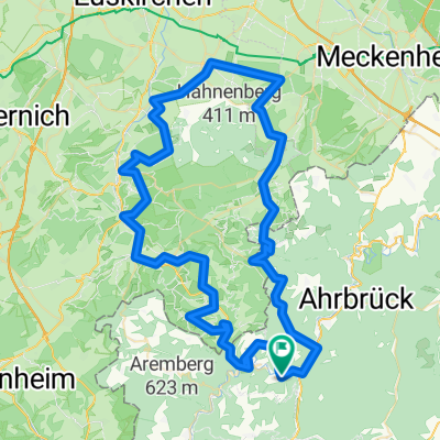
Ahrtal-Insul-Hönningen (W)
A cycling route starting in Insul, Rhineland-Palatinate, Germany.
Overview
About this route
Mit Jörn gelaufen - sehr schön und abwechslungsreich.
- -:--
- Duration
- 17.8 km
- Distance
- 473 m
- Ascent
- 473 m
- Descent
- ---
- Avg. speed
- ---
- Max. altitude

Route quality
Waytypes & surfaces along the route
Waytypes
Track
10 km
(56 %)
Path
5.1 km
(28 %)
Surfaces
Paved
5 km
(28 %)
Unpaved
8.4 km
(47 %)
Ground
6.5 km
(37 %)
Asphalt
4.8 km
(27 %)
Continue with Bikemap
Use, edit, or download this cycling route
You would like to ride Ahrtal-Insul-Hönningen (W) or customize it for your own trip? Here is what you can do with this Bikemap route:
Free features
- Save this route as favorite or in collections
- Copy & plan your own version of this route
- Sync your route with Garmin or Wahoo
Premium features
Free trial for 3 days, or one-time payment. More about Bikemap Premium.
- Navigate this route on iOS & Android
- Export a GPX / KML file of this route
- Create your custom printout (try it for free)
- Download this route for offline navigation
Discover more Premium features.
Get Bikemap PremiumFrom our community
Other popular routes starting in Insul
 Insul-Reifferscheid-Niederadenau-Runde 24km
- Distance
- 23.8 km
- Ascent
- 555 m
- Descent
- 559 m
- Location
- Insul, Rhineland-Palatinate, Germany
 Insul_O_96K_full
- Distance
- 96.2 km
- Ascent
- 1,190 m
- Descent
- 1,189 m
- Location
- Insul, Rhineland-Palatinate, Germany
 Eifel Tour met toevoegingen
- Distance
- 65.9 km
- Ascent
- 1,041 m
- Descent
- 1,038 m
- Location
- Insul, Rhineland-Palatinate, Germany
 Insul_N_85K_Short2
- Distance
- 85.1 km
- Ascent
- 1,228 m
- Descent
- 1,228 m
- Location
- Insul, Rhineland-Palatinate, Germany
 2.Etappe_Ahr_Kyll
- Distance
- 78 km
- Ascent
- 344 m
- Descent
- 276 m
- Location
- Insul, Rhineland-Palatinate, Germany
 40 Radarena 1250hm
- Distance
- 40 km
- Ascent
- 846 m
- Descent
- 844 m
- Location
- Insul, Rhineland-Palatinate, Germany
 RLP7a: Insul - Windhagen 67,1km 394hm
- Distance
- 67.2 km
- Ascent
- 394 m
- Descent
- 328 m
- Location
- Insul, Rhineland-Palatinate, Germany
 Insul_ZW_90K_Full
- Distance
- 91.6 km
- Ascent
- 1,319 m
- Descent
- 1,318 m
- Location
- Insul, Rhineland-Palatinate, Germany
Open it in the app