

TOUR DU MONT BLANC #TMB
A cycling route starting in Courmayeur, Aosta Valley, Italy.
Overview
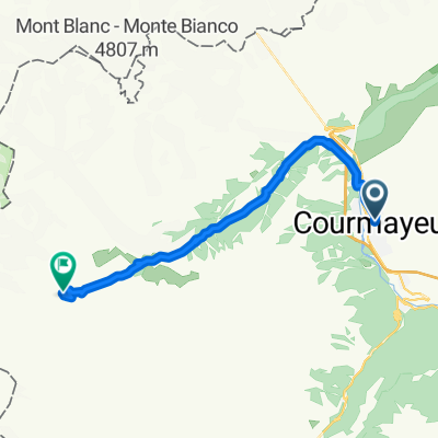
About this route
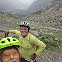
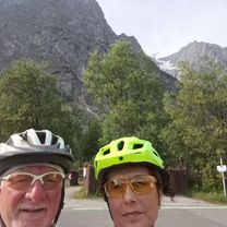
Tour du Mont Blanc Enduro Bikepacking Trip #TMB, an spectacular track that goes around Mont Blanc (4810m). We biked around the tallest peaks in Europe that rises between green valleys and white glaciers. We sow marmots all over we looked, big bearded vulture and ibexs. We biked around 200km (80% rideable and 20% pushbike) in 3 countries and climbed over 8500m elevation in 5 days, 20% paved, 30% forest road and 50% singletrack !!!
- -:--
- Duration
- 170.7 km
- Distance
- 6,341 m
- Ascent
- 6,341 m
- Descent
- ---
- Avg. speed
- ---
- Max. altitude

Continue with Bikemap
Use, edit, or download this cycling route
You would like to ride TOUR DU MONT BLANC #TMB or customize it for your own trip? Here is what you can do with this Bikemap route:
Free features
- Save this route as favorite or in collections
- Copy & plan your own version of this route
- Split it into stages to create a multi-day tour
- Sync your route with Garmin or Wahoo
Premium features
Free trial for 3 days, or one-time payment. More about Bikemap Premium.
- Navigate this route on iOS & Android
- Export a GPX / KML file of this route
- Create your custom printout (try it for free)
- Download this route for offline navigation
Discover more Premium features.
Get Bikemap PremiumFrom our community
Other popular routes starting in Courmayeur
 TMB day 3
- Distance
- 33.8 km
- Ascent
- 1,838 m
- Descent
- 1,561 m
- Location
- Courmayeur, Aosta Valley, Italy
 Courmayeur To Val Ferret
- Distance
- 40.4 km
- Ascent
- 1,067 m
- Descent
- 1,057 m
- Location
- Courmayeur, Aosta Valley, Italy
 Da G. Jorasses (20) a Località Pré De Bar
- Distance
- 12 km
- Ascent
- 490 m
- Descent
- 89 m
- Location
- Courmayeur, Aosta Valley, Italy
 Col de la Seigne
- Distance
- 37.6 km
- Ascent
- 1,327 m
- Descent
- 1,338 m
- Location
- Courmayeur, Aosta Valley, Italy
 Da Località Planpincieux a G. Jorasses (20)
- Distance
- 13.7 km
- Ascent
- 140 m
- Descent
- 201 m
- Location
- Courmayeur, Aosta Valley, Italy
 Bonatti-Bertone
- Distance
- 15.1 km
- Ascent
- 936 m
- Descent
- 817 m
- Location
- Courmayeur, Aosta Valley, Italy
 GRAN FONDO MONTE BIANCO
- Distance
- 129.3 km
- Ascent
- 2,993 m
- Descent
- 2,991 m
- Location
- Courmayeur, Aosta Valley, Italy
 Rifugio Elisabetta
- Distance
- 16.2 km
- Ascent
- 1,067 m
- Descent
- 107 m
- Location
- Courmayeur, Aosta Valley, Italy
Open it in the app