
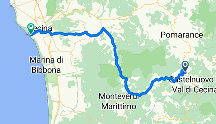
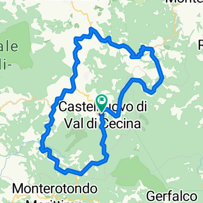
Down_Hil_Toscana
A cycling route starting in Castelnuovo di Val di Cecina, Tuscany, Italy.
Overview
About this route
- -:--
- Duration
- 52.2 km
- Distance
- 364 m
- Ascent
- 788 m
- Descent
- ---
- Avg. speed
- ---
- Max. altitude

Route quality
Waytypes & surfaces along the route
Waytypes
Quiet road
6.3 km
(12 %)
Road
2.6 km
(5 %)
Surfaces
Paved
35 km
(67 %)
Unpaved
2.1 km
(4 %)
Asphalt
35 km
(67 %)
Unpaved (undefined)
1 km
(2 %)
Continue with Bikemap
Use, edit, or download this cycling route
You would like to ride Down_Hil_Toscana or customize it for your own trip? Here is what you can do with this Bikemap route:
Free features
- Save this route as favorite or in collections
- Copy & plan your own version of this route
- Sync your route with Garmin or Wahoo
Premium features
Free trial for 3 days, or one-time payment. More about Bikemap Premium.
- Navigate this route on iOS & Android
- Export a GPX / KML file of this route
- Create your custom printout (try it for free)
- Download this route for offline navigation
Discover more Premium features.
Get Bikemap PremiumFrom our community
Other popular routes starting in Castelnuovo di Val di Cecina
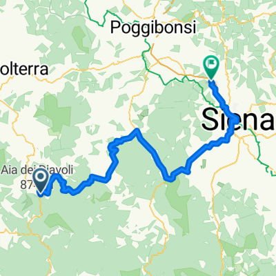
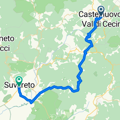 Castelnuovo di Val di Cecina - Suvereto
- Distance
- 43.4 km
- Ascent
- 968 m
- Descent
- 1,518 m
- Location
- Castelnuovo di Val di Cecina, Tuscany, Italy
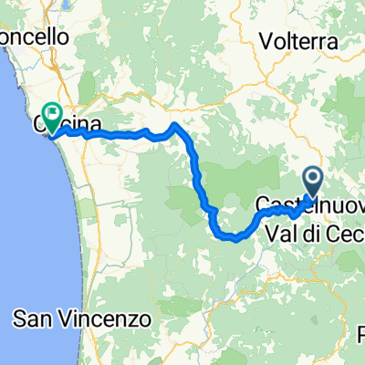 Down_Hil_Toscana
- Distance
- 52.2 km
- Ascent
- 364 m
- Descent
- 788 m
- Location
- Castelnuovo di Val di Cecina, Tuscany, Italy
 TOSCANA - day 2
- Distance
- 48.6 km
- Ascent
- 838 m
- Descent
- 909 m
- Location
- Castelnuovo di Val di Cecina, Tuscany, Italy
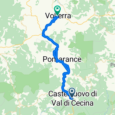
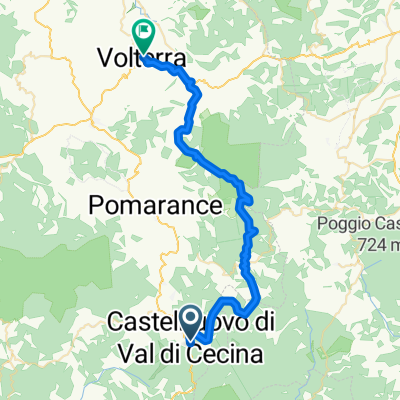 Castelnuovo Val Di Cecina - Volterra
- Distance
- 40.4 km
- Ascent
- 837 m
- Descent
- 883 m
- Location
- Castelnuovo di Val di Cecina, Tuscany, Italy
 Lengthy bike tour from 08.06.17, 18:56
- Distance
- 77.8 km
- Ascent
- 735 m
- Descent
- 1,073 m
- Location
- Castelnuovo di Val di Cecina, Tuscany, Italy
 Tuscany day 1
- Distance
- 49 km
- Ascent
- 1,130 m
- Descent
- 1,137 m
- Location
- Castelnuovo di Val di Cecina, Tuscany, Italy
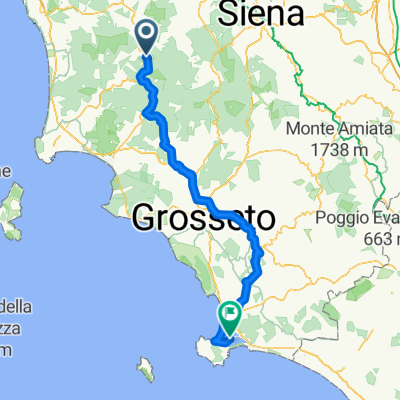 Etappe 09 Castelnuovo - Ortobello
- Distance
- 151.1 km
- Ascent
- 819 m
- Descent
- 1,392 m
- Location
- Castelnuovo di Val di Cecina, Tuscany, Italy
 Toscana 08.06.2017
- Distance
- 86.8 km
- Ascent
- 766 m
- Descent
- 1,108 m
- Location
- Castelnuovo di Val di Cecina, Tuscany, Italy
Open it in the app