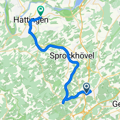
Radrevier Ruhr
A cycling route starting in Sprockhövel, North Rhine-Westphalia, Germany.
Overview
About this route
The combination of former railway tracks transformed into fine bike paths, the nature of the Ennepe-Ruhr district, and the industrial culture along the way make the 58-kilometer bike tour a unique experience.
The train station in Hattingen is the ideal starting point for the tour. If you are arriving by car, starting at the parking lot of Henrichshütte in Hattingen is also an option.
- -:--
- Duration
- 58.4 km
- Distance
- 333 m
- Ascent
- 332 m
- Descent
- ---
- Avg. speed
- ---
- Max. altitude
Route quality
Waytypes & surfaces along the route
Waytypes
Path
32.1 km
(55 %)
Quiet road
9.9 km
(17 %)
Surfaces
Paved
33.9 km
(58 %)
Unpaved
21 km
(36 %)
Asphalt
32.7 km
(56 %)
Gravel
16.9 km
(29 %)
Continue with Bikemap
Use, edit, or download this cycling route
You would like to ride Radrevier Ruhr or customize it for your own trip? Here is what you can do with this Bikemap route:
Free features
- Save this route as favorite or in collections
- Copy & plan your own version of this route
- Sync your route with Garmin or Wahoo
Premium features
Free trial for 3 days, or one-time payment. More about Bikemap Premium.
- Navigate this route on iOS & Android
- Export a GPX / KML file of this route
- Create your custom printout (try it for free)
- Download this route for offline navigation
Discover more Premium features.
Get Bikemap PremiumFrom our community
Other popular routes starting in Sprockhövel
Radrevier Ruhr- Distance
- 58.4 km
- Ascent
- 333 m
- Descent
- 332 m
- Location
- Sprockhövel, North Rhine-Westphalia, Germany
Ruhrtalfähre Kemnader See von Schee- Distance
- 59.6 km
- Ascent
- 730 m
- Descent
- 733 m
- Location
- Sprockhövel, North Rhine-Westphalia, Germany
68 Km - Sprockhövel - Baldeneysee- Distance
- 68.5 km
- Ascent
- 226 m
- Descent
- 224 m
- Location
- Sprockhövel, North Rhine-Westphalia, Germany
Sprockhövel - Hattingen- Distance
- 11.8 km
- Ascent
- 161 m
- Descent
- 237 m
- Location
- Sprockhövel, North Rhine-Westphalia, Germany
Schöne Feierabendrunde- Distance
- 33.5 km
- Ascent
- 320 m
- Descent
- 349 m
- Location
- Sprockhövel, North Rhine-Westphalia, Germany
Nordbahntrasse- Distance
- 27 km
- Ascent
- 305 m
- Descent
- 388 m
- Location
- Sprockhövel, North Rhine-Westphalia, Germany
R38: Von Ruhr zur Ruhr- Distance
- 56.9 km
- Ascent
- 770 m
- Descent
- 769 m
- Location
- Sprockhövel, North Rhine-Westphalia, Germany
Von Sprockhövel bis Hattingen- Distance
- 22 km
- Ascent
- 341 m
- Descent
- 445 m
- Location
- Sprockhövel, North Rhine-Westphalia, Germany
Open it in the app


