

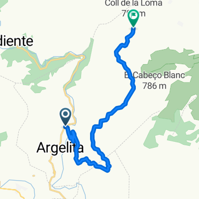
ROAD Argelita-Lucena-Remolcador-Zucaina-La_Massada-Villahermosa-Puertomingalvo-Villahermosa-Castillo-Ludiente-Argelita 124k 3020m
A cycling route starting in Argelita, Valencia, Spain.
Overview
About this route
ROAD Argelita-Lucena-Remolcador-Zucaina-La_Massada-Villahermosa-Puertomingalvo-Villahermosa-Castillo-Ludiente-Argelita 124k 3020m
- -:--
- Duration
- 123.6 km
- Distance
- 2,307 m
- Ascent
- 2,304 m
- Descent
- ---
- Avg. speed
- ---
- Max. altitude
Route quality
Waytypes & surfaces along the route
Waytypes
Road
69.2 km
(56 %)
Quiet road
2.5 km
(2 %)
Undefined
51.9 km
(42 %)
Surfaces
Paved
24.7 km
(20 %)
Asphalt
24.7 km
(20 %)
Undefined
98.9 km
(80 %)
Continue with Bikemap
Use, edit, or download this cycling route
You would like to ride ROAD Argelita-Lucena-Remolcador-Zucaina-La_Massada-Villahermosa-Puertomingalvo-Villahermosa-Castillo-Ludiente-Argelita 124k 3020m or customize it for your own trip? Here is what you can do with this Bikemap route:
Free features
- Save this route as favorite or in collections
- Copy & plan your own version of this route
- Split it into stages to create a multi-day tour
- Sync your route with Garmin or Wahoo
Premium features
Free trial for 3 days, or one-time payment. More about Bikemap Premium.
- Navigate this route on iOS & Android
- Export a GPX / KML file of this route
- Create your custom printout (try it for free)
- Download this route for offline navigation
Discover more Premium features.
Get Bikemap PremiumFrom our community
Other popular routes starting in Argelita
 Argelita-Castillo-Lucena-Argelita
- Distance
- 56.5 km
- Ascent
- 1,077 m
- Descent
- 1,077 m
- Location
- Argelita, Valencia, Spain
 ludiente puerto
- Distance
- 45.9 km
- Ascent
- 1,515 m
- Descent
- 357 m
- Location
- Argelita, Valencia, Spain
 Argelita-Castillo Villamalefa-Zucaina_Montanejos_Argelita
- Distance
- 69.6 km
- Ascent
- 1,039 m
- Descent
- 1,036 m
- Location
- Argelita, Valencia, Spain
 PUERTO EL REMOLCADOR (por Argelita)
- Distance
- 21.8 km
- Ascent
- 723 m
- Descent
- 54 m
- Location
- Argelita, Valencia, Spain
 ROAD Argelita-ColaCaballo-Remolcador-Puertomingalvo-LaMassada-CastilloVillamalefa-Argelita 120k 3000m
- Distance
- 118.9 km
- Ascent
- 2,236 m
- Descent
- 2,234 m
- Location
- Argelita, Valencia, Spain
 MAS del MORO, por Argelita
- Distance
- 10.3 km
- Ascent
- 539 m
- Descent
- 73 m
- Location
- Argelita, Valencia, Spain
 ROAD Argelita-Lucena-Remolcador-Zucaina-La_Massada-Villahermosa-Puertomingalvo-Villahermosa-Castillo-Ludiente-Argelita 124k 3020m
- Distance
- 123.6 km
- Ascent
- 2,307 m
- Descent
- 2,304 m
- Location
- Argelita, Valencia, Spain
 Argelita - Puertomingalvo
- Distance
- 124.4 km
- Ascent
- 4,697 m
- Descent
- 4,531 m
- Location
- Argelita, Valencia, Spain
Open it in the app