

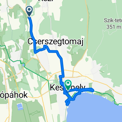
Kis Balaton
A cycling route starting in Cserszegtomaj, Zala County, Hungary.
Overview
About this route
Kányavári sziget, Kápolnapuszta bivalyrezervátum, Zalakaros
- -:--
- Duration
- 75.4 km
- Distance
- 226 m
- Ascent
- 220 m
- Descent
- ---
- Avg. speed
- ---
- Max. altitude

Route quality
Waytypes & surfaces along the route
Waytypes
Cycleway
10.6 km
(14 %)
Quiet road
9.8 km
(13 %)
Surfaces
Paved
56.5 km
(75 %)
Unpaved
6 km
(8 %)
Asphalt
56.5 km
(75 %)
Gravel
5.3 km
(7 %)
Continue with Bikemap
Use, edit, or download this cycling route
You would like to ride Kis Balaton or customize it for your own trip? Here is what you can do with this Bikemap route:
Free features
- Save this route as favorite or in collections
- Copy & plan your own version of this route
- Sync your route with Garmin or Wahoo
Premium features
Free trial for 3 days, or one-time payment. More about Bikemap Premium.
- Navigate this route on iOS & Android
- Export a GPX / KML file of this route
- Create your custom printout (try it for free)
- Download this route for offline navigation
Discover more Premium features.
Get Bikemap PremiumFrom our community
Other popular routes starting in Cserszegtomaj
 Az Ördög nyomában Várvögyről
- Distance
- 29.7 km
- Ascent
- 462 m
- Descent
- 459 m
- Location
- Cserszegtomaj, Zala County, Hungary
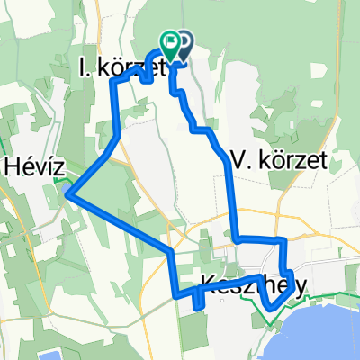
 Heviz Rundtour 40 KM
- Distance
- 38.8 km
- Ascent
- 243 m
- Descent
- 243 m
- Location
- Cserszegtomaj, Zala County, Hungary
 Kis Balaton
- Distance
- 75.4 km
- Ascent
- 226 m
- Descent
- 220 m
- Location
- Cserszegtomaj, Zala County, Hungary
 Von Cserszegtomaj nach Balatongyörök
- Distance
- 34.4 km
- Ascent
- 1,772 m
- Descent
- 1,814 m
- Location
- Cserszegtomaj, Zala County, Hungary
 Az Ördög nyomában Zalaszántóról
- Distance
- 22.5 km
- Ascent
- 423 m
- Descent
- 423 m
- Location
- Cserszegtomaj, Zala County, Hungary
 HU-App Hibiskus-Keszthely-21km
- Distance
- 20.1 km
- Ascent
- 90 m
- Descent
- 102 m
- Location
- Cserszegtomaj, Zala County, Hungary
 Tesi feladat
- Distance
- 19.8 km
- Ascent
- 225 m
- Descent
- 208 m
- Location
- Cserszegtomaj, Zala County, Hungary
 Balaton-felvidék 01
- Distance
- 117 km
- Ascent
- 800 m
- Descent
- 802 m
- Location
- Cserszegtomaj, Zala County, Hungary
Open it in the app