

Elmtour
A cycling route starting in Isenbüttel, Lower Saxony, Germany.
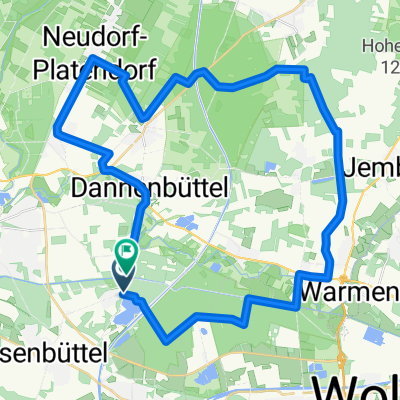
Overview
About this route
Scenically very diverse. Not far from Isenbüttel, there is the possibility to swim in the Tankumsee, etc.
Resting options in Elm/Tetzelstein, Königslutter, and Uhry. Shortcuts from Königslutter via Lauingen, Rotenkamp, Kampstühl, Lehre, and Gr. Brunsrode.
- -:--
- Duration
- 95.5 km
- Distance
- 433 m
- Ascent
- 419 m
- Descent
- ---
- Avg. speed
- 313 m
- Max. altitude

Route quality
Waytypes & surfaces along the route
Waytypes
Road
24.8 km
(26 %)
Path
22 km
(23 %)
Surfaces
Paved
81.2 km
(85 %)
Unpaved
5.7 km
(6 %)
Asphalt
79.3 km
(83 %)
Paved (undefined)
1.9 km
(2 %)
Continue with Bikemap
Use, edit, or download this cycling route
You would like to ride Elmtour or customize it for your own trip? Here is what you can do with this Bikemap route:
Free features
- Save this route as favorite or in collections
- Copy & plan your own version of this route
- Split it into stages to create a multi-day tour
- Sync your route with Garmin or Wahoo
Premium features
Free trial for 3 days, or one-time payment. More about Bikemap Premium.
- Navigate this route on iOS & Android
- Export a GPX / KML file of this route
- Create your custom printout (try it for free)
- Download this route for offline navigation
Discover more Premium features.
Get Bikemap PremiumFrom our community
Other popular routes starting in Isenbüttel
 Wipshausen
- Distance
- 68 km
- Ascent
- 110 m
- Descent
- 109 m
- Location
- Isenbüttel, Lower Saxony, Germany
 Runde über die Dörfer
- Distance
- 18.3 km
- Ascent
- 64 m
- Descent
- 66 m
- Location
- Isenbüttel, Lower Saxony, Germany
 Sonntagstour2
- Distance
- 33.9 km
- Ascent
- 71 m
- Descent
- 66 m
- Location
- Isenbüttel, Lower Saxony, Germany
 Weyhausen, Bokensdorf, Westerbeck, E-Bike
- Distance
- 40.6 km
- Ascent
- 83 m
- Descent
- 81 m
- Location
- Isenbüttel, Lower Saxony, Germany
 Elmtour
- Distance
- 95.5 km
- Ascent
- 433 m
- Descent
- 419 m
- Location
- Isenbüttel, Lower Saxony, Germany
 Tankumsee, Weyhausen, Allersee, am Kanal zurück
- Distance
- 38.9 km
- Ascent
- 37 m
- Descent
- 34 m
- Location
- Isenbüttel, Lower Saxony, Germany
 Wasser- und Waldtour
- Distance
- 55 km
- Ascent
- 187 m
- Descent
- 177 m
- Location
- Isenbüttel, Lower Saxony, Germany
 Wehyhausen, Brechtorf, Rühen, Kanal zurück
- Distance
- 55.7 km
- Ascent
- 63 m
- Descent
- 63 m
- Location
- Isenbüttel, Lower Saxony, Germany
Open it in the app