

D'Autunno sui colli del Tour
D'Autunno sui colli del Tour - Tappa 2: Col du Telegraphe e Galibier
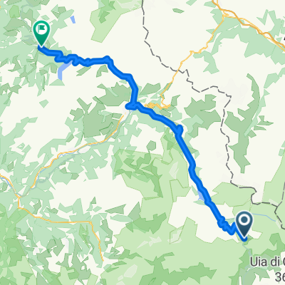
A cycling route starting in Val d'Isère, Auvergne-Rhône-Alpes, France.
Overview
About this route
- -:--
- Duration
- 93.2 km
- Distance
- 2,108 m
- Ascent
- 1,831 m
- Descent
- ---
- Avg. speed
- ---
- Max. altitude

Part of
D'Autunno sui colli del Tour
3 stages
Route quality
Waytypes & surfaces along the route
Waytypes
Quiet road
5.6 km
(6 %)
Road
4.7 km
(5 %)
Surfaces
Paved
75.5 km
(81 %)
Unpaved
0.9 km
(1 %)
Asphalt
75.5 km
(81 %)
Gravel
0.9 km
(1 %)
Undefined
16.8 km
(18 %)
Continue with Bikemap
Use, edit, or download this cycling route
You would like to ride D'Autunno sui colli del Tour - Tappa 2: Col du Telegraphe e Galibier or customize it for your own trip? Here is what you can do with this Bikemap route:
Free features
- Save this route as favorite or in collections
- Copy & plan your own version of this route
- Split it into stages to create a multi-day tour
- Sync your route with Garmin or Wahoo
Premium features
Free trial for 3 days, or one-time payment. More about Bikemap Premium.
- Navigate this route on iOS & Android
- Export a GPX / KML file of this route
- Create your custom printout (try it for free)
- Download this route for offline navigation
Discover more Premium features.
Get Bikemap PremiumFrom our community
Other popular routes starting in Val d'Isère
 France Transalp Etappe4
- Distance
- 163.9 km
- Ascent
- 3,398 m
- Descent
- 3,845 m
- Location
- Val d'Isère, Auvergne-Rhône-Alpes, France
 ADH - Etappe2
- Distance
- 127.1 km
- Ascent
- 2,636 m
- Descent
- 3,500 m
- Location
- Val d'Isère, Auvergne-Rhône-Alpes, France
 3. Etappe: Val d'Isere - Saint-Jean-de-Maurienne
- Distance
- 108.2 km
- Ascent
- 1,667 m
- Descent
- 2,792 m
- Location
- Val d'Isère, Auvergne-Rhône-Alpes, France
 LANSLEVILLARD-AOSTA
- Distance
- 129.3 km
- Ascent
- 2,491 m
- Descent
- 3,365 m
- Location
- Val d'Isère, Auvergne-Rhône-Alpes, France
 Tag 7. Val d Isere - Briancon Alternativ
- Distance
- 159.9 km
- Ascent
- 3,013 m
- Descent
- 3,633 m
- Location
- Val d'Isère, Auvergne-Rhône-Alpes, France
 lidl-tour-2015-2-5
- Distance
- 103.7 km
- Ascent
- 2,541 m
- Descent
- 2,402 m
- Location
- Val d'Isère, Auvergne-Rhône-Alpes, France
 Val-d'Isère - Beaufort
- Distance
- 77.5 km
- Ascent
- 929 m
- Descent
- 2,659 m
- Location
- Val d'Isère, Auvergne-Rhône-Alpes, France
 RdGA Tag 4
- Distance
- 105.1 km
- Ascent
- 1,854 m
- Descent
- 2,275 m
- Location
- Val d'Isère, Auvergne-Rhône-Alpes, France
Open it in the app