

D'Autunno sui colli del Tour
D'Autunno sui colli del Tour - Tappa 3: Col de L'Izoard e Monginevro
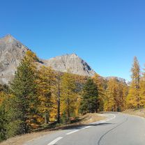
A cycling route starting in Le Monêtier-les-Bains, Provence-Alpes-Côte d'Azur Region, France.
Overview
About this route
- -:--
- Duration
- 83.1 km
- Distance
- 1,785 m
- Ascent
- 2,127 m
- Descent
- ---
- Avg. speed
- ---
- Max. altitude

Part of
D'Autunno sui colli del Tour
3 stages
Route quality
Waytypes & surfaces along the route
Waytypes
Quiet road
5.8 km
(7 %)
Access road
3.3 km
(4 %)
Surfaces
Paved
57.3 km
(69 %)
Unpaved
1.7 km
(2 %)
Asphalt
57.3 km
(69 %)
Unpaved (undefined)
0.8 km
(1 %)
Continue with Bikemap
Use, edit, or download this cycling route
You would like to ride D'Autunno sui colli del Tour - Tappa 3: Col de L'Izoard e Monginevro or customize it for your own trip? Here is what you can do with this Bikemap route:
Free features
- Save this route as favorite or in collections
- Copy & plan your own version of this route
- Split it into stages to create a multi-day tour
- Sync your route with Garmin or Wahoo
Premium features
Free trial for 3 days, or one-time payment. More about Bikemap Premium.
- Navigate this route on iOS & Android
- Export a GPX / KML file of this route
- Create your custom printout (try it for free)
- Download this route for offline navigation
Discover more Premium features.
Get Bikemap PremiumFrom our community
Other popular routes starting in Le Monêtier-les-Bains
 Tour de France 2008 - Tag 4 L`Alp D`Huez
- Distance
- 52 km
- Ascent
- 1,585 m
- Descent
- 1,802 m
- Location
- Le Monêtier-les-Bains, Provence-Alpes-Côte d'Azur Region, France
 Le Col du Galibier, depuis le Lautaret
- Distance
- 8.7 km
- Ascent
- 592 m
- Descent
- 5 m
- Location
- Le Monêtier-les-Bains, Provence-Alpes-Côte d'Azur Region, France
 Col du Lautaret - Col du Galibier
- Distance
- 8.7 km
- Ascent
- 605 m
- Descent
- 27 m
- Location
- Le Monêtier-les-Bains, Provence-Alpes-Côte d'Azur Region, France
 Lago Thures
- Distance
- 4.4 km
- Ascent
- 587 m
- Descent
- 33 m
- Location
- Le Monêtier-les-Bains, Provence-Alpes-Côte d'Azur Region, France
 27-6: Col du Galibier
- Distance
- 52.9 km
- Ascent
- 1,791 m
- Descent
- 1,781 m
- Location
- Le Monêtier-les-Bains, Provence-Alpes-Côte d'Azur Region, France
 Epic last day.
- Distance
- 218.2 km
- Ascent
- 4,898 m
- Descent
- 4,935 m
- Location
- Le Monêtier-les-Bains, Provence-Alpes-Côte d'Azur Region, France
 Etape 1
- Distance
- 9.9 km
- Ascent
- 746 m
- Descent
- 118 m
- Location
- Le Monêtier-les-Bains, Provence-Alpes-Côte d'Azur Region, France
 RdGA - 'rustdag' Col du Lautaret - L'Alpe d'Huez - Col du Lautaret
- Distance
- 100.7 km
- Ascent
- 2,371 m
- Descent
- 2,371 m
- Location
- Le Monêtier-les-Bains, Provence-Alpes-Côte d'Azur Region, France
Open it in the app