

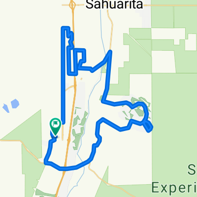
Continental/Mission to Helmet Peak
A cycling route starting in Green Valley, Arizona, United States.
Overview
About this route
- -:--
- Duration
- 38.9 km
- Distance
- 235 m
- Ascent
- 238 m
- Descent
- ---
- Avg. speed
- ---
- Max. altitude

Route quality
Waytypes & surfaces along the route
Waytypes
Quiet road
6.2 km
(16 %)
Road
5.8 km
(15 %)
Surfaces
Paved
11.7 km
(30 %)
Asphalt
11.3 km
(29 %)
Paved (undefined)
0.4 km
(1 %)
Undefined
27.3 km
(70 %)
Continue with Bikemap
Use, edit, or download this cycling route
You would like to ride Continental/Mission to Helmet Peak or customize it for your own trip? Here is what you can do with this Bikemap route:
Free features
- Save this route as favorite or in collections
- Copy & plan your own version of this route
- Sync your route with Garmin or Wahoo
Premium features
Free trial for 3 days, or one-time payment. More about Bikemap Premium.
- Navigate this route on iOS & Android
- Export a GPX / KML file of this route
- Create your custom printout (try it for free)
- Download this route for offline navigation
Discover more Premium features.
Get Bikemap PremiumFrom our community
Other popular routes starting in Green Valley
 Canoa Hills (backwards)
- Distance
- 25 km
- Ascent
- 109 m
- Descent
- 111 m
- Location
- Green Valley, Arizona, United States
 S Helvetia Rd, Sonoita to S Helvetia Rd, Green Valley
- Distance
- 13.5 km
- Ascent
- 174 m
- Descent
- 183 m
- Location
- Green Valley, Arizona, United States
 Doug's GV Ramble
- Distance
- 43.8 km
- Ascent
- 151 m
- Descent
- 153 m
- Location
- Green Valley, Arizona, United States
 121 W Calle Nogal, Green Valley to 748 N Cedar Bend Ave, Green Valley
- Distance
- 10.1 km
- Ascent
- 75 m
- Descent
- 58 m
- Location
- Green Valley, Arizona, United States
 720 N Observation Trail, Green Valley to E Sam Lena Dr, Tucson
- Distance
- 70.3 km
- Ascent
- 227 m
- Descent
- 367 m
- Location
- Green Valley, Arizona, United States
 Madera Highlands to South Tucson loop via Wilmont
- Distance
- 76.9 km
- Ascent
- 133 m
- Descent
- 135 m
- Location
- Green Valley, Arizona, United States
 Continental/Mission to Helmet Peak
- Distance
- 38.9 km
- Ascent
- 235 m
- Descent
- 238 m
- Location
- Green Valley, Arizona, United States
 749 N Rugged Canyon Dr, Green Valley to 121 W Calle Nogal, Green Valley
- Distance
- 4.7 km
- Ascent
- 17 m
- Descent
- 68 m
- Location
- Green Valley, Arizona, United States
Open it in the app