

29/10 Cafe Ventoux
A cycling route starting in Glenfield, England, United Kingdom.
Overview
About this route
Cafe V 05/11
- -:--
- Duration
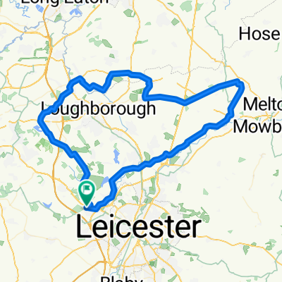
- 86 km
- Distance
- 423 m
- Ascent
- 423 m
- Descent
- ---
- Avg. speed
- ---
- Max. altitude

Route quality
Waytypes & surfaces along the route
Waytypes
Road
47.3 km
(55 %)
Quiet road
34.4 km
(40 %)
Surfaces
Paved
14.6 km
(17 %)
Asphalt
13.8 km
(16 %)
Paved (undefined)
0.9 km
(1 %)
Undefined
71.3 km
(83 %)
Continue with Bikemap
Use, edit, or download this cycling route
You would like to ride 29/10 Cafe Ventoux or customize it for your own trip? Here is what you can do with this Bikemap route:
Free features
- Save this route as favorite or in collections
- Copy & plan your own version of this route
- Split it into stages to create a multi-day tour
- Sync your route with Garmin or Wahoo
Premium features
Free trial for 3 days, or one-time payment. More about Bikemap Premium.
- Navigate this route on iOS & Android
- Export a GPX / KML file of this route
- Create your custom printout (try it for free)
- Download this route for offline navigation
Discover more Premium features.
Get Bikemap PremiumFrom our community
Other popular routes starting in Glenfield
 Usual Run
- Distance
- 9.5 km
- Ascent
- 64 m
- Descent
- 63 m
- Location
- Glenfield, England, United Kingdom
 Route #3
- Distance
- 38.3 km
- Ascent
- 407 m
- Descent
- 407 m
- Location
- Glenfield, England, United Kingdom
 29/7 Ride
- Distance
- 80.3 km
- Ascent
- 389 m
- Descent
- 388 m
- Location
- Glenfield, England, United Kingdom
 Daisy’s Tearooms 🍰☕️
- Distance
- 22.5 km
- Ascent
- 109 m
- Descent
- 107 m
- Location
- Glenfield, England, United Kingdom
 Moira and National Forest
- Distance
- 67 km
- Ascent
- 417 m
- Descent
- 418 m
- Location
- Glenfield, England, United Kingdom
 29/10 Cafe Ventoux
- Distance
- 86 km
- Ascent
- 423 m
- Descent
- 423 m
- Location
- Glenfield, England, United Kingdom
 Groby to Cafe Ventoux
- Distance
- 56 km
- Ascent
- 314 m
- Descent
- 229 m
- Location
- Glenfield, England, United Kingdom
 20140615_170134.gpx
- Distance
- 32.3 km
- Ascent
- 237 m
- Descent
- 236 m
- Location
- Glenfield, England, United Kingdom
Open it in the app