

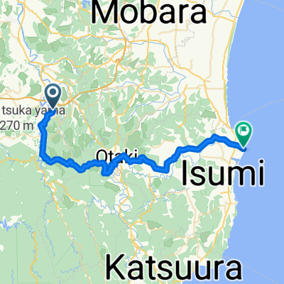
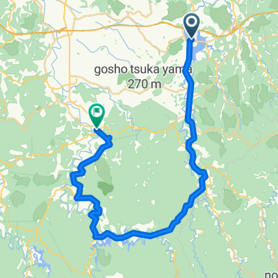
BR-TakatakiL2-OtakiC2
A cycling route starting in Mobara, Chiba, Japan.
Overview
About this route
- -:--
- Duration
- 39 km
- Distance
- 557 m
- Ascent
- 559 m
- Descent
- ---
- Avg. speed
- ---
- Max. altitude

Route quality
Waytypes & surfaces along the route
Waytypes
Quiet road
7.4 km
(19 %)
Road
1.6 km
(4 %)
Undefined
30.1 km
(77 %)
Surfaces
Paved
1.2 km
(3 %)
Paved (undefined)
1.2 km
(3 %)
Undefined
37.9 km
(97 %)
Continue with Bikemap
Use, edit, or download this cycling route
You would like to ride BR-TakatakiL2-OtakiC2 or customize it for your own trip? Here is what you can do with this Bikemap route:
Free features
- Save this route as favorite or in collections
- Copy & plan your own version of this route
- Sync your route with Garmin or Wahoo
Premium features
Free trial for 3 days, or one-time payment. More about Bikemap Premium.
- Navigate this route on iOS & Android
- Export a GPX / KML file of this route
- Create your custom printout (try it for free)
- Download this route for offline navigation
Discover more Premium features.
Get Bikemap PremiumFrom our community
Other popular routes starting in Mobara
 BR-Tsukizaki-Otaki-Osaka
- Distance
- 58.6 km
- Ascent
- 768 m
- Descent
- 769 m
- Location
- Mobara, Chiba, Japan
 BR-Otaki-Taito
- Distance
- 41.6 km
- Ascent
- 302 m
- Descent
- 293 m
- Location
- Mobara, Chiba, Japan
 Tsukizaki-Kururi-Yoro-Tsukizaki
- Distance
- 50.3 km
- Ascent
- 674 m
- Descent
- 667 m
- Location
- Mobara, Chiba, Japan
 BAC-Takataki-Kururi
- Distance
- 36.2 km
- Ascent
- 415 m
- Descent
- 413 m
- Location
- Mobara, Chiba, Japan
 Tsukizaki-Kururi-Kameyamako-Yorokeikoku
- Distance
- 41.6 km
- Ascent
- 713 m
- Descent
- 724 m
- Location
- Mobara, Chiba, Japan
 BAC-Tsukizaki-Otaki
- Distance
- 13.5 km
- Ascent
- 323 m
- Descent
- 382 m
- Location
- Mobara, Chiba, Japan
 BR-Takataki-Ohara
- Distance
- 51.1 km
- Ascent
- 303 m
- Descent
- 339 m
- Location
- Mobara, Chiba, Japan
 Boso-Kururi-Daifukuyama
- Distance
- 45.7 km
- Ascent
- 445 m
- Descent
- 447 m
- Location
- Mobara, Chiba, Japan
Open it in the app