

08-Jaegerkamp-Schneeschuh
A cycling route starting in Fischbachau, Bavaria, Germany.
Overview
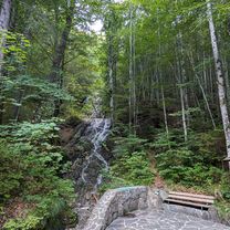
About this route
Summit route with a view of Schliersee lake
- -:--
- Duration
- 11.6 km
- Distance
- 694 m
- Ascent
- 697 m
- Descent
- ---
- Avg. speed
- ---
- Max. altitude

Route quality
Waytypes & surfaces along the route
Waytypes
Track
8 km
(69 %)
Path
3.1 km
(27 %)
Surfaces
Paved
6.7 km
(58 %)
Unpaved
2.2 km
(19 %)
Asphalt
6.6 km
(57 %)
Gravel
1.9 km
(16 %)
Route highlights
Points of interest along the route

Point of interest after 4.6 km
Blick auf Schnittlauchmoosalm Bildquelle: hoehenrausch.de

Point of interest after 5.6 km
Sicht auf Benzingspitz Bildquelle: hoehenrausch.de

Point of interest after 6.2 km
Gipfelkreuz Jägerkamp Bildquelle: hoehenrausch.de

Point of interest after 7.8 km
Schönfeldhütte Bildquelle: tourentipp.de

Point of interest after 7.9 km
Rauhkopfhütte Bildquelle: hoehenrausch.de
Continue with Bikemap
Use, edit, or download this cycling route
You would like to ride 08-Jaegerkamp-Schneeschuh or customize it for your own trip? Here is what you can do with this Bikemap route:
Free features
- Save this route as favorite or in collections
- Copy & plan your own version of this route
- Sync your route with Garmin or Wahoo
Premium features
Free trial for 3 days, or one-time payment. More about Bikemap Premium.
- Navigate this route on iOS & Android
- Export a GPX / KML file of this route
- Create your custom printout (try it for free)
- Download this route for offline navigation
Discover more Premium features.
Get Bikemap PremiumFrom our community
Other popular routes starting in Fischbachau
 Schliersee-Tegernsee
- Distance
- 52.8 km
- Ascent
- 962 m
- Descent
- 1,212 m
- Location
- Fischbachau, Bavaria, Germany
 Rottach-Spitzing-Sudelfeld-Tatzelwurm-Runde
- Distance
- 114.8 km
- Ascent
- 1,442 m
- Descent
- 1,442 m
- Location
- Fischbachau, Bavaria, Germany
 Rund um die Rotwand (ab/bis Neuhaus)
- Distance
- 40.4 km
- Ascent
- 1,004 m
- Descent
- 1,004 m
- Location
- Fischbachau, Bavaria, Germany
 Übern Spitzingsattel zur Oberen Schönfeldalm
- Distance
- 19.6 km
- Ascent
- 870 m
- Descent
- 844 m
- Location
- Fischbachau, Bavaria, Germany
 Von Neuhaus über den Soinsee zum Rotwandhaus
- Distance
- 29.4 km
- Ascent
- 1,059 m
- Descent
- 1,059 m
- Location
- Fischbachau, Bavaria, Germany
 08-Jaegerkamp-Schneeschuh
- Distance
- 11.6 km
- Ascent
- 694 m
- Descent
- 697 m
- Location
- Fischbachau, Bavaria, Germany
 Spitzingsee - Hammer - Zipflwirt - Valepp - Spitzingsee
- Distance
- 44.4 km
- Ascent
- 737 m
- Descent
- 781 m
- Location
- Fischbachau, Bavaria, Germany
 Von Neuhaus über den Soinsee zum Rotwandhaus
- Distance
- 29.4 km
- Ascent
- 1,013 m
- Descent
- 1,013 m
- Location
- Fischbachau, Bavaria, Germany
Open it in the app