

camminata valle calandrella-campo giordano
A cycling route starting in Vetralla, Lazio, Italy.
Overview
About this route
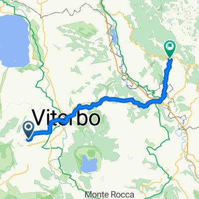
route: via giardino-via crocetta-valle calandrella-via fortezze-via cassia-campo giordano-via cairoli-wood-left on white road until central aqueduct-via s.angelo-strada carcarelle-via giardino.
- -:--
- Duration
- 8.1 km
- Distance
- 82 m
- Ascent
- 80 m
- Descent
- ---
- Avg. speed
- ---
- Max. altitude

Route quality
Waytypes & surfaces along the route
Waytypes
Quiet road
3.4 km
(42 %)
Road
2.2 km
(27 %)
Surfaces
Paved
4 km
(50 %)
Unpaved
1.4 km
(17 %)
Asphalt
4 km
(50 %)
Ground
1.4 km
(17 %)
Undefined
2.7 km
(33 %)
Continue with Bikemap
Use, edit, or download this cycling route
You would like to ride camminata valle calandrella-campo giordano or customize it for your own trip? Here is what you can do with this Bikemap route:
Free features
- Save this route as favorite or in collections
- Copy & plan your own version of this route
- Sync your route with Garmin or Wahoo
Premium features
Free trial for 3 days, or one-time payment. More about Bikemap Premium.
- Navigate this route on iOS & Android
- Export a GPX / KML file of this route
- Create your custom printout (try it for free)
- Download this route for offline navigation
Discover more Premium features.
Get Bikemap PremiumFrom our community
Other popular routes starting in Vetralla
 giro di S.Angelo
- Distance
- 9.9 km
- Ascent
- 293 m
- Descent
- 294 m
- Location
- Vetralla, Lazio, Italy
 Transapp 2.1
- Distance
- 57.7 km
- Ascent
- 647 m
- Descent
- 487 m
- Location
- Vetralla, Lazio, Italy
 dom 19 feb23_Vetralla-Santa Marinella
- Distance
- 54.8 km
- Ascent
- 980 m
- Descent
- 1,360 m
- Location
- Vetralla, Lazio, Italy
 giro Penna in Tev.-Alviano-Grotte S.Stefano
- Distance
- 123.3 km
- Ascent
- 1,081 m
- Descent
- 1,080 m
- Location
- Vetralla, Lazio, Italy
 Bicoca, Monteromano, SP97, Tarquinia
- Distance
- 51.2 km
- Ascent
- 452 m
- Descent
- 606 m
- Location
- Vetralla, Lazio, Italy
 transappenninica seconda tappa
- Distance
- 70.4 km
- Ascent
- 704 m
- Descent
- 570 m
- Location
- Vetralla, Lazio, Italy
 camminata valle calandrella-campo giordano
- Distance
- 8.1 km
- Ascent
- 82 m
- Descent
- 80 m
- Location
- Vetralla, Lazio, Italy
 Vetralla antica sosta francigena - Capranica B&B Monticelli
- Distance
- 19.1 km
- Ascent
- 286 m
- Descent
- 233 m
- Location
- Vetralla, Lazio, Italy
Open it in the app