

2017 出巡繞境
A cycling route starting in Chang-hua, Taiwan, Taiwan.
Overview
About this route
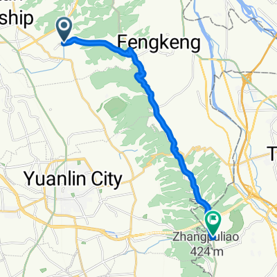
Changhua Train Station -> Bagua Mountain (pilgrimage for deities, Bagua Mountain Skywalk) -> 139 -> Yinsan (watching cows eat ice cream) -> Fengshan Temple -> Bald Cypress Forest -> Smiling Sky Ladder -> 139B -> Songbai Mountain -> Fengbai Road (throw 35 down to Ershui) -> Ershui (Old Street) -> Cross the Zhuoshuizi River -> Lin Nei No. 2 Dike (Jiannan Canal) Agricultural Water Resource Heritage Museum (Bagua Pond) -> New Huwei Creek Dike -> Xiluo -> Accommodation
Xiluo -> Xizhou (Xizhou Houtian Temple, Wanjing Art Garden) -> Beidou (meatball shop) -> Tianwei (Road Garden, Huifeng Gardening) -> Xihu (lamb hot pot) -> High-speed rail
- -:--
- Duration
- 108.9 km
- Distance
- 596 m
- Ascent
- 575 m
- Descent
- ---
- Avg. speed
- ---
- Max. altitude
Route quality
Waytypes & surfaces along the route
Waytypes
Road
24 km
(22 %)
Quiet road
19.6 km
(18 %)
Surfaces
Paved
41.4 km
(38 %)
Asphalt
41.4 km
(38 %)
Undefined
67.5 km
(62 %)
Continue with Bikemap
Use, edit, or download this cycling route
You would like to ride 2017 出巡繞境 or customize it for your own trip? Here is what you can do with this Bikemap route:
Free features
- Save this route as favorite or in collections
- Copy & plan your own version of this route
- Split it into stages to create a multi-day tour
- Sync your route with Garmin or Wahoo
Premium features
Free trial for 3 days, or one-time payment. More about Bikemap Premium.
- Navigate this route on iOS & Android
- Export a GPX / KML file of this route
- Create your custom printout (try it for free)
- Download this route for offline navigation
Discover more Premium features.
Get Bikemap PremiumFrom our community
Other popular routes starting in Chang-hua
 東外環-三分橋-員林大碗公
- Distance
- 42.9 km
- Ascent
- 368 m
- Descent
- 371 m
- Location
- Chang-hua, Taiwan, Taiwan
 中彰轉-139 路段 車少空氣好
- Distance
- 35 km
- Ascent
- 452 m
- Descent
- 425 m
- Location
- Chang-hua, Taiwan, Taiwan
 虎山岩-日月山景
- Distance
- 19.7 km
- Ascent
- 237 m
- Descent
- 232 m
- Location
- Chang-hua, Taiwan, Taiwan
 2009.4.12 快官~八卦山~賞鷹平臺~楊桃崎~禾家~四面佛O型
- Distance
- 30.2 km
- Ascent
- 572 m
- Descent
- 568 m
- Location
- Chang-hua, Taiwan, Taiwan
 花壇三芬橋到鳳山寺
- Distance
- 14.2 km
- Ascent
- 429 m
- Descent
- 75 m
- Location
- Chang-hua, Taiwan, Taiwan
 聖安路
聖安路- Distance
- 18.6 km
- Ascent
- 204 m
- Descent
- 126 m
- Location
- Chang-hua, Taiwan, Taiwan
 2011_09_25 第二屆 環化賽
- Distance
- 107.8 km
- Ascent
- 458 m
- Descent
- 460 m
- Location
- Chang-hua, Taiwan, Taiwan
 別毛山林道
別毛山林道- Distance
- 126.7 km
- Ascent
- 1,311 m
- Descent
- 1,311 m
- Location
- Chang-hua, Taiwan, Taiwan
Open it in the app