

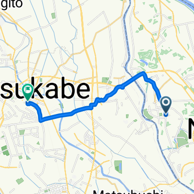
BR-Noda-SekiyadoC
A cycling route starting in Noda, Chiba, Japan.
Overview
About this route
- -:--
- Duration
- 45.9 km
- Distance
- 32 m
- Ascent
- 30 m
- Descent
- ---
- Avg. speed
- ---
- Max. altitude

Route quality
Waytypes & surfaces along the route
Waytypes
Cycleway
23.9 km
(52 %)
Quiet road
9.6 km
(21 %)
Surfaces
Paved
16.1 km
(35 %)
Paved (undefined)
11.9 km
(26 %)
Asphalt
4.1 km
(9 %)
Undefined
29.8 km
(65 %)
Continue with Bikemap
Use, edit, or download this cycling route
You would like to ride BR-Noda-SekiyadoC or customize it for your own trip? Here is what you can do with this Bikemap route:
Free features
- Save this route as favorite or in collections
- Copy & plan your own version of this route
- Sync your route with Garmin or Wahoo
Premium features
Free trial for 3 days, or one-time payment. More about Bikemap Premium.
- Navigate this route on iOS & Android
- Export a GPX / KML file of this route
- Create your custom printout (try it for free)
- Download this route for offline navigation
Discover more Premium features.
Get Bikemap PremiumFrom our community
Other popular routes starting in Noda
 836-10, Noda, Noda to 1243, Onigakubo, Tsukuba
- Distance
- 26.8 km
- Ascent
- 168 m
- Descent
- 160 m
- Location
- Noda, Chiba, Japan
 unga-himeji
- Distance
- 640.2 km
- Ascent
- 1,437 m
- Descent
- 1,439 m
- Location
- Noda, Chiba, Japan
 BR-Noda-SekiyadoC
- Distance
- 45.9 km
- Ascent
- 32 m
- Descent
- 30 m
- Location
- Noda, Chiba, Japan
 BR-Noda-Sekiyado
- Distance
- 22.4 km
- Ascent
- 44 m
- Descent
- 40 m
- Location
- Noda, Chiba, Japan
 matsuhidai to unga river route
- Distance
- 27.1 km
- Ascent
- 75 m
- Descent
- 69 m
- Location
- Noda, Chiba, Japan
 2-chōme 28, Noda to 1-chōme 10, Kasukabe
- Distance
- 11.7 km
- Ascent
- 70 m
- Descent
- 79 m
- Location
- Noda, Chiba, Japan
 流山街道, Noda to Goka
- Distance
- 27.4 km
- Ascent
- 114 m
- Descent
- 124 m
- Location
- Noda, Chiba, Japan
 松伏町 to 1丁目 1, さいたま市
- Distance
- 16 km
- Ascent
- 12 m
- Descent
- 28 m
- Location
- Noda, Chiba, Japan
Open it in the app