
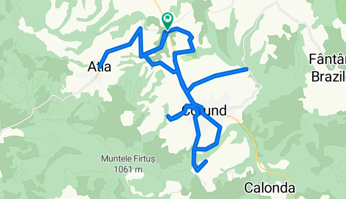
Athya-Korond+kornyezo aszfaltozott agrarutak
A cycling route starting in Ocna de Sus, Harghita County, Romania.
Overview
About this route
Athya-Korond+surrounding paved agricultural roads (approx.)
- -:--
- Duration
- 38.3 km
- Distance
- 895 m
- Ascent
- 895 m
- Descent
- ---
- Avg. speed
- ---
- Max. altitude
Continue with Bikemap
Use, edit, or download this cycling route
You would like to ride Athya-Korond+kornyezo aszfaltozott agrarutak or customize it for your own trip? Here is what you can do with this Bikemap route:
Free features
- Save this route as favorite or in collections
- Copy & plan your own version of this route
- Sync your route with Garmin or Wahoo
Premium features
Free trial for 3 days, or one-time payment. More about Bikemap Premium.
- Navigate this route on iOS & Android
- Export a GPX / KML file of this route
- Create your custom printout (try it for free)
- Download this route for offline navigation
Discover more Premium features.
Get Bikemap PremiumFrom our community
Other popular routes starting in Ocna de Sus
 Athya-Korond+kornyezo aszfaltozott agrarutak
- Distance
- 38.3 km
- Ascent
- 895 m
- Descent
- 895 m
- Location
- Ocna de Sus, Harghita County, Romania
 Ocna de Sus Cycling
- Distance
- 53.3 km
- Ascent
- 1,098 m
- Descent
- 1,077 m
- Location
- Ocna de Sus, Harghita County, Romania
 2019.04.27_Bucsin
- Distance
- 66.3 km
- Ascent
- 1,040 m
- Descent
- 1,041 m
- Location
- Ocna de Sus, Harghita County, Romania
 R. Ocna de Sus, Bucin, culme, Eremitu
- Distance
- 70.6 km
- Ascent
- 1,551 m
- Descent
- 1,498 m
- Location
- Ocna de Sus, Harghita County, Romania
 Alsósófalva - Szencsed
- Distance
- 49.3 km
- Ascent
- 725 m
- Descent
- 725 m
- Location
- Ocna de Sus, Harghita County, Romania
 Ocna de Sus Cycling
- Distance
- 68.7 km
- Ascent
- 1,406 m
- Descent
- 1,393 m
- Location
- Ocna de Sus, Harghita County, Romania
 R. Ocna de Sus, Fantana Brazilor, Stauie I , VT
- Distance
- 45.5 km
- Ascent
- 987 m
- Descent
- 635 m
- Location
- Ocna de Sus, Harghita County, Romania
 Sófalva-Varság-Fenyőkút
- Distance
- 66.5 km
- Ascent
- 1,283 m
- Descent
- 1,285 m
- Location
- Ocna de Sus, Harghita County, Romania
Open it in the app