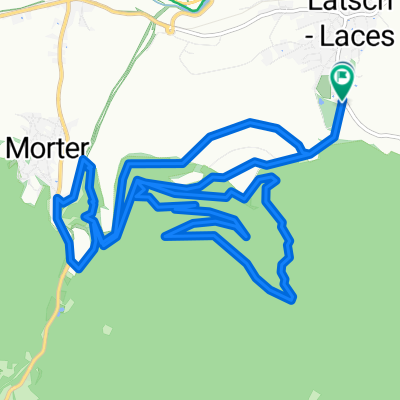
Uphill Morterer Leger
A cycling route starting in Latsch, Trentino-Alto Adige, Italy.
Overview
About this route
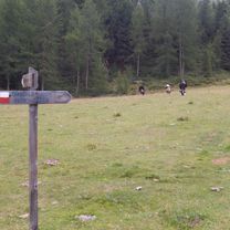
Knackige, schattige Tour mit lohnenden Aussichten und Anschluss zur Jausenstation Haslhof und dem legendären Holy Hansen-Trail. Wir starten in der beschaulich, gemütlichen Latscher Fraktion Morter beim Hotel Krone und biegen vorbei am Kulturhaus und der Feuerwehrhalle rechts die Asphaltstraße hinauf Richtung Putzenhof. Links haltend geht’s vorbei an dessen Erdbeeranbauflächen und Apfelgärten durch das Nationalparktor bis hinauf zum Wetterkreuz. Im Schatten des Nörderbergs zieht sich nun der Forstweg mit konstanter Steigung bis zum Morterer Leger auf 1.705m. Zuerst ist der Weg mit weißem Marmorschotter gut präpariert, ab der Hälfte ist dieser fast ausschließlich mit Gras und Moos bedeckt. Am Ziel wird man mit einem traumhaften Picknickplatz und dem Ausblick auf den Gipfel des Hasenohr (3.257m) belohnt. Abfahrt über Forstweg oder über den 7A bzw. den Forstweg eine Kehre unterhalb weiter zur Jausenstation Haslhof und zum Holy Hansen-Trail (S2 ) bzw. Marmorbruch.
- -:--
- Duration
- 8.6 km
- Distance
- 982 m
- Ascent
- 4 m
- Descent
- ---
- Avg. speed
- ---
- Max. altitude
Continue with Bikemap
Use, edit, or download this cycling route
You would like to ride Uphill Morterer Leger or customize it for your own trip? Here is what you can do with this Bikemap route:
Free features
- Save this route as favorite or in collections
- Copy & plan your own version of this route
- Sync your route with Garmin or Wahoo
Premium features
Free trial for 3 days, or one-time payment. More about Bikemap Premium.
- Navigate this route on iOS & Android
- Export a GPX / KML file of this route
- Create your custom printout (try it for free)
- Download this route for offline navigation
Discover more Premium features.
Get Bikemap PremiumFrom our community
Other popular routes starting in Latsch
 Goldrain - Ruine Schloss Montani - Trimdichpfad Latsch - Radweg / St. Martin Seilbahn ;)
- Distance
- 11.9 km
- Ascent
- 1,885 m
- Descent
- 1,953 m
- Location
- Latsch, Trentino-Alto Adige, Italy
 Vinschgau 05 (Haslhof)
- Distance
- 28.6 km
- Ascent
- 1,284 m
- Descent
- 1,284 m
- Location
- Latsch, Trentino-Alto Adige, Italy
 Latsch Trail 13 Runde S2
- Distance
- 16.9 km
- Ascent
- 734 m
- Descent
- 730 m
- Location
- Latsch, Trentino-Alto Adige, Italy
 Martelltal bis zum Stausee
- Distance
- 48.9 km
- Ascent
- 1,551 m
- Descent
- 1,542 m
- Location
- Latsch, Trentino-Alto Adige, Italy
 Transalp Schmuggler 4
- Distance
- 35.1 km
- Ascent
- 1,936 m
- Descent
- 1,324 m
- Location
- Latsch, Trentino-Alto Adige, Italy
 über die Bärenböden
- Distance
- 28.5 km
- Ascent
- 1,098 m
- Descent
- 1,098 m
- Location
- Latsch, Trentino-Alto Adige, Italy
 Latscher Trail Zauber S2 (gross)
- Distance
- 15.8 km
- Ascent
- 552 m
- Descent
- 553 m
- Location
- Latsch, Trentino-Alto Adige, Italy
 LatscherAlm-TarscherAlm-MarzonerAlm Tour S2
- Distance
- 48.7 km
- Ascent
- 2,023 m
- Descent
- 2,024 m
- Location
- Latsch, Trentino-Alto Adige, Italy
Open it in the app


