

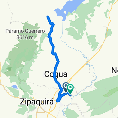
ruta bababuy
A cycling route starting in Cogua, Cundinamarca, Colombia.
Overview
About this route
desde el pueblo de cogua, alto de la laguna, las mercedes. alto del marne, monteluz, brasil
- -:--
- Duration
- 75.4 km
- Distance
- 1,512 m
- Ascent
- 2,592 m
- Descent
- ---
- Avg. speed
- ---
- Max. altitude
Route quality
Waytypes & surfaces along the route
Waytypes
Road
40.1 km
(53 %)
Quiet road
32.3 km
(43 %)
Surfaces
Unpaved
27 km
(36 %)
Gravel
13.6 km
(18 %)
Unpaved (undefined)
9.3 km
(12 %)
Continue with Bikemap
Use, edit, or download this cycling route
You would like to ride ruta bababuy or customize it for your own trip? Here is what you can do with this Bikemap route:
Free features
- Save this route as favorite or in collections
- Copy & plan your own version of this route
- Sync your route with Garmin or Wahoo
Premium features
Free trial for 3 days, or one-time payment. More about Bikemap Premium.
- Navigate this route on iOS & Android
- Export a GPX / KML file of this route
- Create your custom printout (try it for free)
- Download this route for offline navigation
Discover more Premium features.
Get Bikemap PremiumFrom our community
Other popular routes starting in Cogua
 alto de la cruz
- Distance
- 19.2 km
- Ascent
- 380 m
- Descent
- 460 m
- Location
- Cogua, Cundinamarca, Colombia
 ruta bababuy
- Distance
- 75.8 km
- Ascent
- 1,448 m
- Descent
- 2,671 m
- Location
- Cogua, Cundinamarca, Colombia
 De Zipaquirá-Nemocón a Calle 4A 7-24
- Distance
- 37.2 km
- Ascent
- 602 m
- Descent
- 627 m
- Location
- Cogua, Cundinamarca, Colombia
 De Entrada Rodamontal la chapa a Via a Represa del Neusa
- Distance
- 21.1 km
- Ascent
- 605 m
- Descent
- 287 m
- Location
- Cogua, Cundinamarca, Colombia
 ruta bababuy
- Distance
- 75.4 km
- Ascent
- 1,512 m
- Descent
- 2,592 m
- Location
- Cogua, Cundinamarca, Colombia
 alto de los romeros pista
- Distance
- 5.5 km
- Ascent
- 173 m
- Descent
- 162 m
- Location
- Cogua, Cundinamarca, Colombia
 Ruta tranquila en la plazuela
- Distance
- 13.5 km
- Ascent
- 710 m
- Descent
- 675 m
- Location
- Cogua, Cundinamarca, Colombia
 Ruta a Calle 4A 7-24
- Distance
- 45.8 km
- Ascent
- 510 m
- Descent
- 538 m
- Location
- Cogua, Cundinamarca, Colombia
Open it in the app