

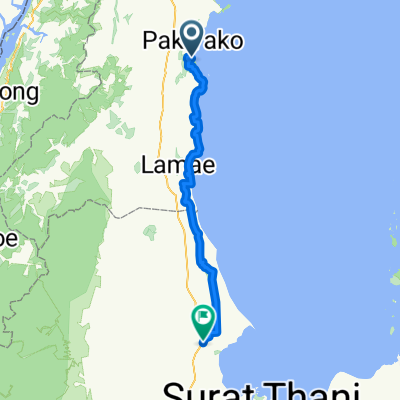
TH_Pak Nam Tako - Prachuap Khiri Khan
A cycling route starting in Thung Tako, Chumphon, Thailand.
Overview
About this route
An der Ostküste immer weiter nordwärts
- -:--
- Duration
- 275.5 km
- Distance
- 361 m
- Ascent
- 363 m
- Descent
- ---
- Avg. speed
- ---
- Max. altitude
Continue with Bikemap
Use, edit, or download this cycling route
You would like to ride TH_Pak Nam Tako - Prachuap Khiri Khan or customize it for your own trip? Here is what you can do with this Bikemap route:
Free features
- Save this route as favorite or in collections
- Copy & plan your own version of this route
- Split it into stages to create a multi-day tour
- Sync your route with Garmin or Wahoo
Premium features
Free trial for 3 days, or one-time payment. More about Bikemap Premium.
- Navigate this route on iOS & Android
- Export a GPX / KML file of this route
- Create your custom printout (try it for free)
- Download this route for offline navigation
Discover more Premium features.
Get Bikemap PremiumFrom our community
Other popular routes starting in Thung Tako
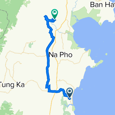
 4096, Amphoe Thung Tako nach Thanon Aphakon, Mueang Chumphon
- Distance
- 64.8 km
- Ascent
- 332 m
- Descent
- 338 m
- Location
- Thung Tako, Chumphon, Thailand
 Von Amphoe Thung Tako bis Amphoe Chaiya
- Distance
- 105.3 km
- Ascent
- 178 m
- Descent
- 174 m
- Location
- Thung Tako, Chumphon, Thailand
 4096, Amphoe Thung Tako nach Bang Son, Pathio
- Distance
- 84.5 km
- Ascent
- 583 m
- Descent
- 585 m
- Location
- Thung Tako, Chumphon, Thailand
 Thung Tako - Tha Chana
- Distance
- 93.6 km
- Ascent
- 1,070 m
- Descent
- 1,106 m
- Location
- Thung Tako, Chumphon, Thailand
 43PP+G2C, Thung Takhrai to Thailand, Tambon Khao Niwet
- Distance
- 86.3 km
- Ascent
- 2,229 m
- Descent
- 2,222 m
- Location
- Thung Tako, Chumphon, Thailand
 Aruntthai Beach to Laem Thong Resort
- Distance
- 111.1 km
- Ascent
- 81 m
- Descent
- 87 m
- Location
- Thung Tako, Chumphon, Thailand
 4198, Amphoe Thung Tako nach 4096, Amphoe Thung Tako
- Distance
- 3.9 km
- Ascent
- 18 m
- Descent
- 11 m
- Location
- Thung Tako, Chumphon, Thailand
 4096, Amphoe Thung Tako nach Wisai Nuea, Mueang Chumphon
- Distance
- 46.3 km
- Ascent
- 376 m
- Descent
- 331 m
- Location
- Thung Tako, Chumphon, Thailand
Open it in the app