

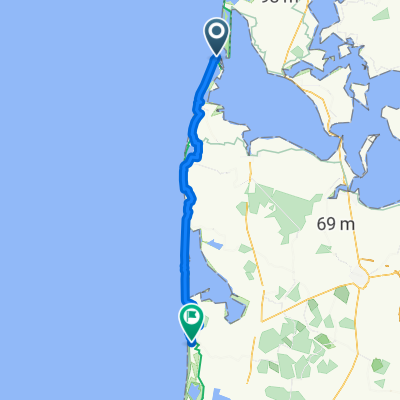
aggertange-Lodbjerg fyr- Stenbjerg
A cycling route starting in Thyborøn, Central Jutland, Denmark.
Overview
About this route
Aggertange-Lodbjerg fyr-Stenbjerg 37 km
- -:--
- Duration
- 37.1 km
- Distance
- 66 m
- Ascent
- 66 m
- Descent
- ---
- Avg. speed
- ---
- Max. altitude

Route quality
Waytypes & surfaces along the route
Waytypes
Cycleway
10.4 km
(28 %)
Track
9.6 km
(26 %)
Surfaces
Paved
23.7 km
(64 %)
Unpaved
13.7 km
(37 %)
Asphalt
19.3 km
(52 %)
Gravel
12.2 km
(33 %)
Continue with Bikemap
Use, edit, or download this cycling route
You would like to ride aggertange-Lodbjerg fyr- Stenbjerg or customize it for your own trip? Here is what you can do with this Bikemap route:
Free features
- Save this route as favorite or in collections
- Copy & plan your own version of this route
- Sync your route with Garmin or Wahoo
Premium features
Free trial for 3 days, or one-time payment. More about Bikemap Premium.
- Navigate this route on iOS & Android
- Export a GPX / KML file of this route
- Create your custom printout (try it for free)
- Download this route for offline navigation
Discover more Premium features.
Get Bikemap PremiumFrom our community
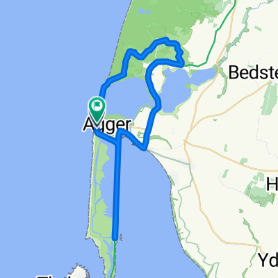
Other popular routes starting in Thyborøn
 39_Thyboron-Henneby_2016-08-02
- Distance
- 130.9 km
- Ascent
- 61 m
- Descent
- 51 m
- Location
- Thyborøn, Central Jutland, Denmark
 Panoramarute 410 on GPSies.com
- Distance
- 43 km
- Ascent
- 202 m
- Descent
- 205 m
- Location
- Thyborøn, Central Jutland, Denmark
 aggertange-Lodbjerg fyr- Stenbjerg
- Distance
- 37.1 km
- Ascent
- 66 m
- Descent
- 66 m
- Location
- Thyborøn, Central Jutland, Denmark
 THYBORON
- Distance
- 27 km
- Ascent
- 42 m
- Descent
- 39 m
- Location
- Thyborøn, Central Jutland, Denmark
 13 Thyboron - Sondervig
- Distance
- 79.4 km
- Ascent
- 82 m
- Descent
- 80 m
- Location
- Thyborøn, Central Jutland, Denmark
 Kirkegaardsvej, Thyborøn nach Christian Hansens Vej, Hanstholm
- Distance
- 72.8 km
- Ascent
- 126 m
- Descent
- 91 m
- Location
- Thyborøn, Central Jutland, Denmark
 Harboørevej to Vedersø Klit (Ringkøbing-Skjern Kom)
- Distance
- 60.2 km
- Ascent
- 99 m
- Descent
- 93 m
- Location
- Thyborøn, Central Jutland, Denmark
 Vesterhavsvej, Vestervig to Agger, Vestervig
- Distance
- 35.4 km
- Ascent
- 57 m
- Descent
- 55 m
- Location
- Thyborøn, Central Jutland, Denmark
Open it in the app