
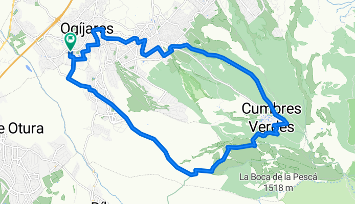
Subida Cumbres Verdes (Guitarra)
A cycling route starting in Ogíjares, Andalusia, Spain.
Overview
About this route
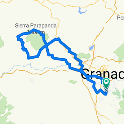
Ascent to Cumbres Verdes via the mountain path and descent along the rocky trail parallel to the Cumbres Verdes road and the lumberjack path.
- -:--
- Duration
- 19.7 km
- Distance
- 520 m
- Ascent
- 520 m
- Descent
- ---
- Avg. speed
- ---
- Max. altitude

Continue with Bikemap
Use, edit, or download this cycling route
You would like to ride Subida Cumbres Verdes (Guitarra) or customize it for your own trip? Here is what you can do with this Bikemap route:
Free features
- Save this route as favorite or in collections
- Copy & plan your own version of this route
- Sync your route with Garmin or Wahoo
Premium features
Free trial for 3 days, or one-time payment. More about Bikemap Premium.
- Navigate this route on iOS & Android
- Export a GPX / KML file of this route
- Create your custom printout (try it for free)
- Download this route for offline navigation
Discover more Premium features.
Get Bikemap PremiumFrom our community
Other popular routes starting in Ogíjares
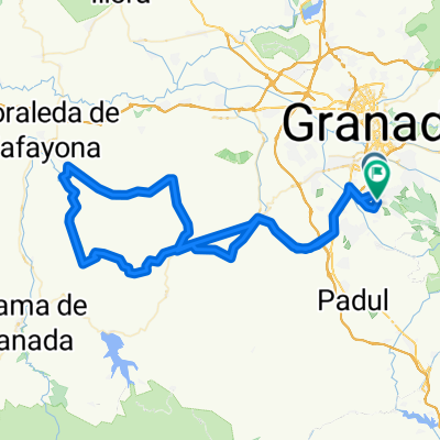
 ogijares-ventas de huelma-jayena-venta del fraile-ogíjares
- Distance
- 86.4 km
- Ascent
- 1,102 m
- Descent
- 1,092 m
- Location
- Ogíjares, Andalusia, Spain
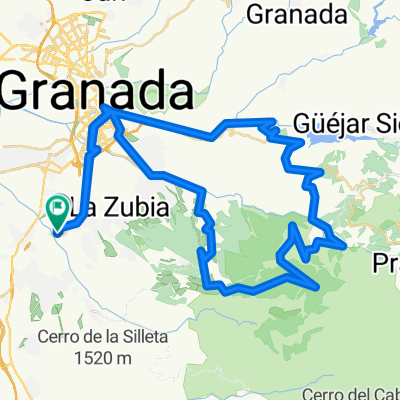
 Gojar-Castillo Tajarja-Gojar
- Distance
- 99 km
- Ascent
- 990 m
- Descent
- 974 m
- Location
- Ogíjares, Andalusia, Spain
 LOMA LINDA-FUENTE DEL HERVIDERO-CARTIJUELA-PICO LA CARNE-PURCHE-PINOS GENIL-LOMA LINDA
- Distance
- 74.4 km
- Ascent
- 1,342 m
- Descent
- 1,344 m
- Location
- Ogíjares, Andalusia, Spain
 Ogíjares - Cubillas
- Distance
- 55.4 km
- Ascent
- 0 m
- Descent
- 0 m
- Location
- Ogíjares, Andalusia, Spain
 Primer GPS - Ogijares-FuenteVaqueros-Belicena
- Distance
- 50.1 km
- Ascent
- 146 m
- Descent
- 307 m
- Location
- Ogíjares, Andalusia, Spain
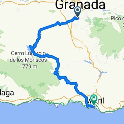 granada motril see
- Distance
- 108.7 km
- Ascent
- 1,479 m
- Descent
- 2,184 m
- Location
- Ogíjares, Andalusia, Spain
 Subida Cumbres Verdes (Guitarra)
- Distance
- 19.7 km
- Ascent
- 520 m
- Descent
- 520 m
- Location
- Ogíjares, Andalusia, Spain
 pixu
pixu- Distance
- 132.3 km
- Ascent
- 1,268 m
- Descent
- 1,298 m
- Location
- Ogíjares, Andalusia, Spain
Open it in the app