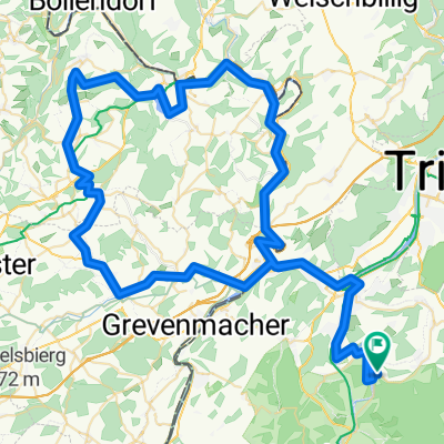
Luxemburg 1
A cycling route starting in Wiltingen, Rhineland-Palatinate, Germany.
Overview
About this route
Diese Tour führt über kleine Straßen durch Luxemburg. Ab Langsur kann bis Echernach auch der fast parallel zur RN 10 verlaufende Radweg genutzt werden.
Sonntag vormittags ist die Strecke sehr verkehrsarm.
- -:--
- Duration
- 98.1 km
- Distance
- 1,035 m
- Ascent
- 1,074 m
- Descent
- ---
- Avg. speed
- 392 m
- Avg. speed
Route quality
Waytypes & surfaces along the route
Waytypes
Busy road
43.5 km
(44 %)
Quiet road
18.1 km
(18 %)
Surfaces
Paved
94.8 km
(97 %)
Unpaved
0.5 km
(<1 %)
Asphalt
94 km
(96 %)
Paving stones
0.4 km
(<1 %)
Continue with Bikemap
Use, edit, or download this cycling route
You would like to ride Luxemburg 1 or customize it for your own trip? Here is what you can do with this Bikemap route:
Free features
- Save this route as favorite or in collections
- Copy & plan your own version of this route
- Sync your route with Garmin or Wahoo
Premium features
Free trial for 3 days, or one-time payment. More about Bikemap Premium.
- Navigate this route on iOS & Android
- Export a GPX / KML file of this route
- Create your custom printout (try it for free)
- Download this route for offline navigation
Discover more Premium features.
Get Bikemap PremiumFrom our community
Other popular routes starting in Wiltingen
- Wiltingen > Saarburg > Könen > Grevenmacher > Mertert > Wasserbillig > Igel > Konz > Kanzem > Wiltingen
- Distance
- 60 km
- Ascent
- 143 m
- Descent
- 141 m
- Location
- Wiltingen, Rhineland-Palatinate, Germany
- Wiltingen > Trier Carl Benz Strasse
- Distance
- 24.6 km
- Ascent
- 85 m
- Descent
- 99 m
- Location
- Wiltingen, Rhineland-Palatinate, Germany
- Mosel: Wiltingen - Mettlach
- Distance
- 88.5 km
- Ascent
- 417 m
- Descent
- 394 m
- Location
- Wiltingen, Rhineland-Palatinate, Germany
- Luxemburg/Saargau
- Distance
- 75.9 km
- Ascent
- 744 m
- Descent
- 704 m
- Location
- Wiltingen, Rhineland-Palatinate, Germany
- Luxemburg 1
- Distance
- 98.1 km
- Ascent
- 1,035 m
- Descent
- 1,074 m
- Location
- Wiltingen, Rhineland-Palatinate, Germany
- Hochwald 7
- Distance
- 78.6 km
- Ascent
- 1,005 m
- Descent
- 1,003 m
- Location
- Wiltingen, Rhineland-Palatinate, Germany
- Wiltingen - Winterspelt
- Distance
- 107.1 km
- Ascent
- 784 m
- Descent
- 460 m
- Location
- Wiltingen, Rhineland-Palatinate, Germany
- Konzer Rundweg
- Distance
- 27.9 km
- Ascent
- 236 m
- Descent
- 235 m
- Location
- Wiltingen, Rhineland-Palatinate, Germany
Open it in the app