

Jabalcuz por Torre del Campo
A cycling route starting in Torre del Campo, Andalusia, Spain.
Overview
About this route
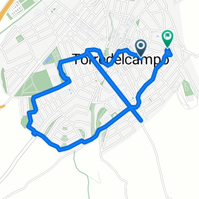
Ascent to the summit of Jabalcuz through the urbanization El Megatín in Torre del Campo. Basically, there are two climbs: the first is up to El Megatín, on asphalt: it is two quite hard kilometers with a small break after 400 meters, after which it gets quite tough until reaching the tower of the electricity point. Then it smoothes out between the houses of the urbanization, before leveling off until reaching the fuente del palo. After that, take the small road on the right until km 6.5, where there is an abandoned quarry, and there the dirt track begins, in poor condition at first but then it smoothes out and with a not very demanding slope we pass the barrier and after about 300 meters of ascent we reach a flat stretch with an abandoned camp to our left. After that, a right turn, and the slope becomes steep with an average of 10% until reaching the Puerto del Aire, at km 10.5. From here, we take the path on the right which, after about 3 kilometers, at first gentle but winding and steepening at the end, leads to the hut at the summit.
- -:--
- Duration
- 13.9 km
- Distance
- 1,049 m
- Ascent
- 92 m
- Descent
- ---
- Avg. speed
- ---
- Max. altitude
Route quality
Waytypes & surfaces along the route
Waytypes
Quiet road
13.5 km
(97 %)
Road
0.4 km
(3 %)
Surfaces
Paved
12 km
(86 %)
Unpaved
1.1 km
(8 %)
Asphalt
12 km
(86 %)
Ground
1.1 km
(8 %)
Undefined
0.8 km
(6 %)
Continue with Bikemap
Use, edit, or download this cycling route
You would like to ride Jabalcuz por Torre del Campo or customize it for your own trip? Here is what you can do with this Bikemap route:
Free features
- Save this route as favorite or in collections
- Copy & plan your own version of this route
- Sync your route with Garmin or Wahoo
Premium features
Free trial for 3 days, or one-time payment. More about Bikemap Premium.
- Navigate this route on iOS & Android
- Export a GPX / KML file of this route
- Create your custom printout (try it for free)
- Download this route for offline navigation
Discover more Premium features.
Get Bikemap PremiumFrom our community
Other popular routes starting in Torre del Campo
 vuelta torrecampo
- Distance
- 33.3 km
- Ascent
- 774 m
- Descent
- 796 m
- Location
- Torre del Campo, Andalusia, Spain
 segundo_dia
- Distance
- 53.5 km
- Ascent
- 1,946 m
- Descent
- 1,911 m
- Location
- Torre del Campo, Andalusia, Spain
 TORREDELCAMPO-SIERRA DE LA GRANA-MARTOS-JAMILENA-TORREDELCAMPO
- Distance
- 37.2 km
- Ascent
- 875 m
- Descent
- 875 m
- Location
- Torre del Campo, Andalusia, Spain
 De Calle Granados 15 Torre del Campo a Calle San Sebastián 103, Torre del Campo
- Distance
- 4.5 km
- Ascent
- 53 m
- Descent
- 36 m
- Location
- Torre del Campo, Andalusia, Spain
 Easy ride in Torredelcampo
- Distance
- 9.5 km
- Ascent
- 194 m
- Descent
- 201 m
- Location
- Torre del Campo, Andalusia, Spain
 Torrecillas - Jabalcuz
- Distance
- 8.6 km
- Ascent
- 724 m
- Descent
- 207 m
- Location
- Torre del Campo, Andalusia, Spain
 De Calle del Cid Campeador, 3, Torredelcampo a Calle del Campeador, 6, Torredelcampo
- Distance
- 18.8 km
- Ascent
- 239 m
- Descent
- 238 m
- Location
- Torre del Campo, Andalusia, Spain
 Jabalcuz por Torre del Campo
- Distance
- 13.9 km
- Ascent
- 1,049 m
- Descent
- 92 m
- Location
- Torre del Campo, Andalusia, Spain
Open it in the app