- 67.3 km
- 759 m
- 782 m
- Hurstbridge, Victoria, Australia
Strathewen
A cycling route starting in Hurstbridge, Victoria, Australia.
Overview
About this route
- -:--
- Duration
- 37.5 km
- Distance
- 279 m
- Ascent
- 279 m
- Descent
- ---
- Avg. speed
- ---
- Max. altitude
created this 8 years ago
Route quality
Waytypes & surfaces along the route
Waytypes
Road
34.5 km
(92 %)
Quiet road
1.1 km
(3 %)
Surfaces
Paved
37.1 km
(99 %)
Paved (undefined)
34.9 km
(93 %)
Asphalt
2.2 km
(6 %)
Undefined
0.4 km
(1 %)
Route highlights
Points of interest along the route
Point of interest after 1.4 km
Bridge
Point of interest after 1.9 km
Haleys Gully Road
Point of interest after 8.8 km
Climb before Arthurs Creek
Point of interest after 9.4 km
Greens Road
Point of interest after 10.7 km
Cottles Bridge-Strathewen Road
Point of interest after 10.8 km
Start Climb
Point of interest after 11.2 km
KOM
Point of interest after 11.9 km
Nankervis Road
Point of interest after 14.9 km
Orchard 1
Point of interest after 16.4 km
Hewitts Road
Point of interest after 17.9 km
Strathewen Public Hall
Point of interest after 18.7 km
Bus Stop
Point of interest after 25.5 km
Eagles Nest Road
Point of interest after 31.1 km
Chapel Lane
Point of interest after 32.4 km
Mine Road
Point of interest after 34.2 km
Pattolous Road
Point of interest after 34.6 km
Boyds Road
Continue with Bikemap
Use, edit, or download this cycling route
You would like to ride Strathewen or customize it for your own trip? Here is what you can do with this Bikemap route:
Free features
- Save this route as favorite or in collections
- Copy & plan your own version of this route
- Sync your route with Garmin or Wahoo
Premium features
Free trial for 3 days, or one-time payment. More about Bikemap Premium.
- Navigate this route on iOS & Android
- Export a GPX / KML file of this route
- Create your custom printout (try it for free)
- Download this route for offline navigation
Discover more Premium features.
Get Bikemap PremiumFrom our community
Other popular routes starting in Hurstbridge
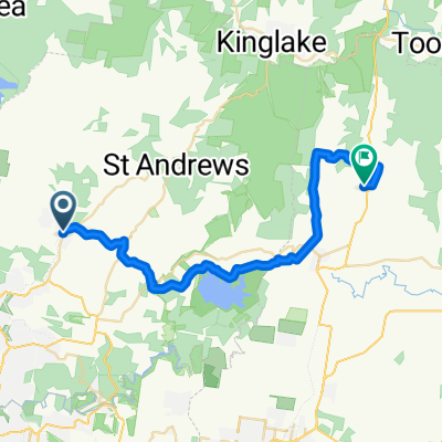
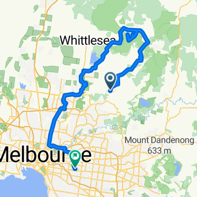
- e-MTB Adventure Ride. Hurstbridge, Whittlesea, Diamond Creek.
- 1 Saturday Morning - Hurstbridge - Yarra Glen (ridge route)
- 34 km
- 514 m
- 468 m
- Hurstbridge, Victoria, Australia
- e-MTB Adventure Ride. Hurstbridge, Doncaster, Surrey Hills.
- 51 km
- 530 m
- 518 m
- Hurstbridge, Victoria, Australia
- Hurstbridge Kinglake
- 56.4 km
- 659 m
- 664 m
- Hurstbridge, Victoria, Australia
- e-MTB Adventure Ride. Hurstbridge, Sugarloaf Reservoir, Warrandyte, Surrey Hills.
- 72.9 km
- 808 m
- 815 m
- Hurstbridge, Victoria, Australia
- e-MTB Adventure Ride. Hurstbridge, Kinglake, Yarra Glen, Eltham.
- 92.2 km
- 1,323 m
- 1,364 m
- Hurstbridge, Victoria, Australia
- e-MTB Adventure Ride. Hurstbridge, Kinglake, Hurstbridge.
- 53.6 km
- 823 m
- 823 m
- Hurstbridge, Victoria, Australia
- e-MTB Adventure Ride. Hurstbridge, Kinglake West, South Morang, Camberwell.
- 119.5 km
- 886 m
- 918 m
- Hurstbridge, Victoria, Australia
Open it in the app


