
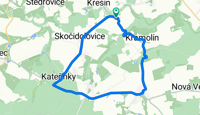
ranni kolecko
A cycling route starting in Lukavec, Kraj Vysočina, Czechia.
Overview
About this route
The more information you write here, the more useful it will be for other users.
- Route progression.
- What is special about this route?
- Why recommend this route?
- What did you like most here?
- Etc.
- -:--
- Duration
- 11 km
- Distance
- 184 m
- Ascent
- 182 m
- Descent
- ---
- Avg. speed
- 662 m
- Max. altitude
Route quality
Waytypes & surfaces along the route
Waytypes
Road
9.1 km
(83 %)
Quiet road
1.9 km
(17 %)
Surfaces
Paved
1 km
(9 %)
Asphalt
1 km
(9 %)
Undefined
10 km
(91 %)
Continue with Bikemap
Use, edit, or download this cycling route
You would like to ride ranni kolecko or customize it for your own trip? Here is what you can do with this Bikemap route:
Free features
- Save this route as favorite or in collections
- Copy & plan your own version of this route
- Sync your route with Garmin or Wahoo
Premium features
Free trial for 3 days, or one-time payment. More about Bikemap Premium.
- Navigate this route on iOS & Android
- Export a GPX / KML file of this route
- Create your custom printout (try it for free)
- Download this route for offline navigation
Discover more Premium features.
Get Bikemap PremiumFrom our community
Other popular routes starting in Lukavec
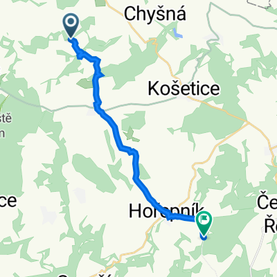 Blažnov 20, Křešín to Rovná, Rovná
- Distance
- 12.5 km
- Ascent
- 238 m
- Descent
- 204 m
- Location
- Lukavec, Kraj Vysočina, Czechia
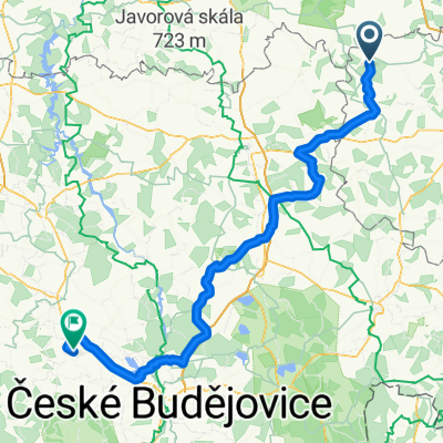
 Silnice 128, Salačova Lhota to Blažnov 20, Křešín
- Distance
- 38.9 km
- Ascent
- 624 m
- Descent
- 711 m
- Location
- Lukavec, Kraj Vysočina, Czechia
 Jelenov - Veselí
- Distance
- 68.4 km
- Ascent
- 533 m
- Descent
- 682 m
- Location
- Lukavec, Kraj Vysočina, Czechia
 2014-09-06
- Distance
- 123.5 km
- Ascent
- 626 m
- Descent
- 842 m
- Location
- Lukavec, Kraj Vysočina, Czechia
 Lukavec- okruh hladkých silnicích
- Distance
- 49 km
- Ascent
- 711 m
- Descent
- 741 m
- Location
- Lukavec, Kraj Vysočina, Czechia
 Bike Tour to Vraník
- Distance
- 21 km
- Ascent
- 352 m
- Descent
- 352 m
- Location
- Lukavec, Kraj Vysočina, Czechia
 salačovka
- Distance
- 31.6 km
- Ascent
- 583 m
- Descent
- 583 m
- Location
- Lukavec, Kraj Vysočina, Czechia
 do naceradce
- Distance
- 15.2 km
- Ascent
- 223 m
- Descent
- 217 m
- Location
- Lukavec, Kraj Vysočina, Czechia
Open it in the app