

Training NW 41 ccw
A cycling route starting in Blagnac, Occitanie, France.
Overview
About this route
B - Beauzelle - Aussonne - Merville - Daux - Bois de Bouconne - B
- -:--
- Duration
- 40.9 km
- Distance
- 96 m
- Ascent
- 96 m
- Descent
- ---
- Avg. speed
- ---
- Max. altitude

Route quality
Waytypes & surfaces along the route
Waytypes
Quiet road
22.1 km
(54 %)
Road
7 km
(17 %)
Surfaces
Paved
29.1 km
(71 %)
Unpaved
1.2 km
(3 %)
Asphalt
28.2 km
(69 %)
Paved (undefined)
0.8 km
(2 %)
Continue with Bikemap
Use, edit, or download this cycling route
You would like to ride Training NW 41 ccw or customize it for your own trip? Here is what you can do with this Bikemap route:
Free features
- Save this route as favorite or in collections
- Copy & plan your own version of this route
- Sync your route with Garmin or Wahoo
Premium features
Free trial for 3 days, or one-time payment. More about Bikemap Premium.
- Navigate this route on iOS & Android
- Export a GPX / KML file of this route
- Create your custom printout (try it for free)
- Download this route for offline navigation
Discover more Premium features.
Get Bikemap PremiumFrom our community
Other popular routes starting in Blagnac
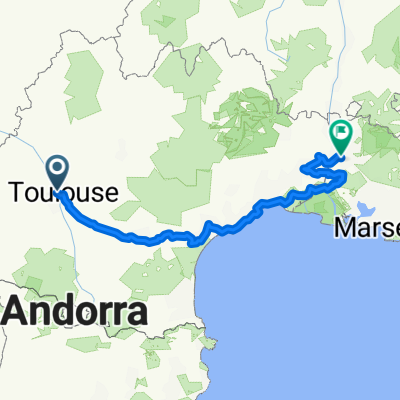 Тулуза-Авиньон
- Distance
- 516 km
- Ascent
- 390 m
- Descent
- 524 m
- Location
- Blagnac, Occitanie, France
 Montsegurdojazd do Quarante 350 km + pociąg za 1 euro
- Distance
- 451.3 km
- Ascent
- 3,618 m
- Descent
- 3,648 m
- Location
- Blagnac, Occitanie, France
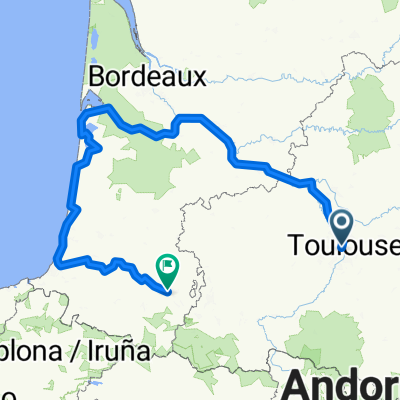 From Toulouse to Saint-Martin-de-Seignanx
- Distance
- 631.7 km
- Ascent
- 3,336 m
- Descent
- 3,285 m
- Location
- Blagnac, Occitanie, France
 TLS-Atlantik-Pyrenäen
- Distance
- 963.2 km
- Ascent
- 2,732 m
- Descent
- 2,728 m
- Location
- Blagnac, Occitanie, France
 Tr 105 km
- Distance
- 105 km
- Ascent
- 201 m
- Descent
- 199 m
- Location
- Blagnac, Occitanie, France
 dojazd z Tuluzy do Quarante
- Distance
- 637.7 km
- Ascent
- 3,278 m
- Descent
- 3,312 m
- Location
- Blagnac, Occitanie, France
 VUELTA
- Distance
- 71.2 km
- Ascent
- 423 m
- Descent
- 422 m
- Location
- Blagnac, Occitanie, France
 Stage 18 Tour de France 2012 From Blagnac to Brive-la-Gaillarde
- Distance
- 227.9 km
- Ascent
- 1,112 m
- Descent
- 1,136 m
- Location
- Blagnac, Occitanie, France
Open it in the app