

Sporty route
- 32.5 km
- 54 m
- 258 m
- Bayt Sīrā, West Bank, Palestine
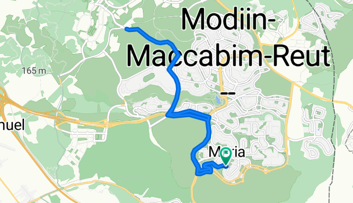
אורך:16 ק"מ
גובה: 290 מטר
תאור: רבקה אמנו, שמאלה ללאה אמנו, ימינה מנחם בגין, ימינה לשדרות החשמונאים, שמאלה ליצחק רבין, ימינה ליהודה המכבי, ימינה לפז, שמאלה בסוף עד לנקודת ה- 8 ק"מ וחזרה.
Road
5.9 km36 %Pedestrian area
2.8 km17 %Paved
11.2 km(69 %)Unpaved
0.2 km(1 %)Asphalt
11.2 km69 %Gravel
0.2 km1 %Undefined
4.9 km30 %Free trial for 3 days, or one-time payment. More about Bikemap Premium.
Discover more Premium features.
Get Bikemap PremiumOpen it in the app


