Giro a Garlasco
A cycling route starting in Garlasco, Lombardy, Italy.
Overview
About this route
Giro a Garlasco
- -:--
- Duration
- 14.7 km
- Distance
- 13 m
- Ascent
- 15 m
- Descent
- ---
- Avg. speed
- ---
- Max. altitude
Route quality
Waytypes & surfaces along the route
Waytypes
Track
10.3 km
(70 %)
Quiet road
3.5 km
(24 %)
Surfaces
Unpaved
11.8 km
(80 %)
Ground
5.6 km
(38 %)
Unpaved (undefined)
5.1 km
(34 %)
Continue with Bikemap
Use, edit, or download this cycling route
You would like to ride Giro a Garlasco or customize it for your own trip? Here is what you can do with this Bikemap route:
Free features
- Save this route as favorite or in collections
- Copy & plan your own version of this route
- Sync your route with Garmin or Wahoo
Premium features
Free trial for 3 days, or one-time payment. More about Bikemap Premium.
- Navigate this route on iOS & Android
- Export a GPX / KML file of this route
- Create your custom printout (try it for free)
- Download this route for offline navigation
Discover more Premium features.
Get Bikemap PremiumFrom our community
Other popular routes starting in Garlasco
- Garlasco_Pavia Via Canarazzo e ritorno Torre d'Isola
- Distance
- 67.3 km
- Ascent
- 71 m
- Descent
- 71 m
- Location
- Garlasco, Lombardy, Italy
- Garlasco-Zeme e ritorno
- Distance
- 50.2 km
- Ascent
- 14 m
- Descent
- 13 m
- Location
- Garlasco, Lombardy, Italy
- Giro dell'Agogna e del Terdoppio
- Distance
- 53.6 km
- Ascent
- 16 m
- Descent
- 13 m
- Location
- Garlasco, Lombardy, Italy
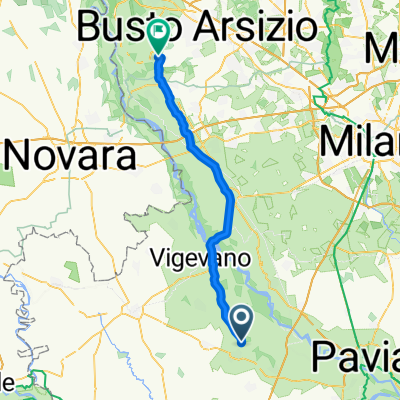
- Giro per la bassa con variante
- Distance
- 51.4 km
- Ascent
- 43 m
- Descent
- 43 m
- Location
- Garlasco, Lombardy, Italy
- Garlasco, Alagna, Dorno, Gropello, Parasacco, Borgo S.Siro, Tromello, Alagna, Garlasco
- Distance
- 44.7 km
- Ascent
- 51 m
- Descent
- 52 m
- Location
- Garlasco, Lombardy, Italy
- Moderate route in Garlasco
- Distance
- 55 km
- Ascent
- 138 m
- Descent
- 138 m
- Location
- Garlasco, Lombardy, Italy
- Giro a Garlasco
- Distance
- 14.7 km
- Ascent
- 13 m
- Descent
- 15 m
- Location
- Garlasco, Lombardy, Italy
- Recovered Route
- Distance
- 37.2 km
- Ascent
- 77 m
- Descent
- 75 m
- Location
- Garlasco, Lombardy, Italy
Open it in the app