

2018-AUT-HUN
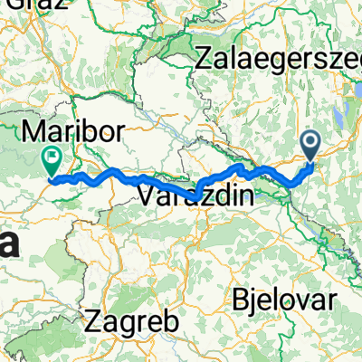
2018 Teil 6. Tag Nagykanizsa - Varazdin
A cycling route starting in Nagykanizsa, Zala County, Hungary.
Overview
About this route
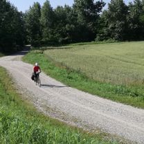
Gefahren am 05. Juni 2018. Der erste Teil war angenehmes Radfahren auf Nebenstraßen durch ungarische Dörfer. Nach dem Grenzübergang sehr schönes Radfahren bis Otock (km 60). Meine Idee nördlich vom See entlangzufahren (km 72) wurde durch den schwierigen Untergrund, den sehr groben Schotter erschwert.
- -:--
- Duration
- 89.8 km
- Distance
- 116 m
- Ascent
- 92 m
- Descent
- ---
- Avg. speed
- ---
- Max. altitude

Part of
6 stages
Route quality
Waytypes & surfaces along the route
Waytypes
Track
17.1 km
(19 %)
Road
16.2 km
(18 %)
Surfaces
Paved
65.6 km
(73 %)
Unpaved
13.5 km
(15 %)
Asphalt
65.6 km
(73 %)
Gravel
13.5 km
(15 %)
Undefined
10.8 km
(12 %)
Continue with Bikemap
Use, edit, or download this cycling route
You would like to ride 2018 Teil 6. Tag Nagykanizsa - Varazdin or customize it for your own trip? Here is what you can do with this Bikemap route:
Free features
- Save this route as favorite or in collections
- Copy & plan your own version of this route
- Split it into stages to create a multi-day tour
- Sync your route with Garmin or Wahoo
Premium features
Free trial for 3 days, or one-time payment. More about Bikemap Premium.
- Navigate this route on iOS & Android
- Export a GPX / KML file of this route
- Create your custom printout (try it for free)
- Download this route for offline navigation
Discover more Premium features.
Get Bikemap PremiumFrom our community
Other popular routes starting in Nagykanizsa
 Murafölde kör 3
- Distance
- 219.8 km
- Ascent
- 2,889 m
- Descent
- 2,891 m
- Location
- Nagykanizsa, Zala County, Hungary
 Vasút utca, Nagykanizsa - Zgornja Ložnica, Zgornja Ložnica
- Distance
- 153.3 km
- Ascent
- 505 m
- Descent
- 367 m
- Location
- Nagykanizsa, Zala County, Hungary
 Tengerre magyar 1.st day
- Distance
- 174.9 km
- Ascent
- 410 m
- Descent
- 437 m
- Location
- Nagykanizsa, Zala County, Hungary
 Nagykanizsa-Milánó 2023
- Distance
- 900.9 km
- Ascent
- 4,743 m
- Descent
- 4,759 m
- Location
- Nagykanizsa, Zala County, Hungary
 Bagolai sor, Nagykanizsa - Bagolai sor, Nagykanizsa
- Distance
- 15.9 km
- Ascent
- 77 m
- Descent
- 79 m
- Location
- Nagykanizsa, Zala County, Hungary
 Obornak_Várdomb
- Distance
- 3.7 km
- Ascent
- 136 m
- Descent
- 8 m
- Location
- Nagykanizsa, Zala County, Hungary
 Várdomb_Homokkomárom_Palin
- Distance
- 18.9 km
- Ascent
- 319 m
- Descent
- 437 m
- Location
- Nagykanizsa, Zala County, Hungary
 Nagykanizsa - Kalinovac
- Distance
- 58 km
- Ascent
- 171 m
- Descent
- 217 m
- Location
- Nagykanizsa, Zala County, Hungary
Open it in the app