Trasy Magiczne: zamki i pałace nad Jeziorakiem
- 127.6 km
- 221 m
- 217 m
- Iława, Warmian-Masurian Voivodeship, Poland
A cycling route starting in Iława, Warmian-Masurian Voivodeship, Poland.
Overview
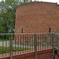
Sarnówek - Zalewo - Buczyniec (REJS) - Pasłęk - Lidzbark Warmiński - Dobre Miasto - Miłakowo - Morąg - Miłomłyn - Iława
created this 8 years ago
Route quality
Road
122.5 km
(38 %)
Quiet road
99.9 km
(31 %)
Paved
138.6 km
(43 %)
Unpaved
70.9 km
(22 %)
Asphalt
132.2 km
(41 %)
Gravel
32.2 km
(10 %)
Continue with Bikemap
You would like to ride Mazury2018-general or customize it for your own trip? Here is what you can do with this Bikemap route:
Free trial for 3 days, or one-time payment. More about Bikemap Premium.
Discover more Premium features.
Get Bikemap PremiumFrom our community
Open it in the app