

Overview
About this route
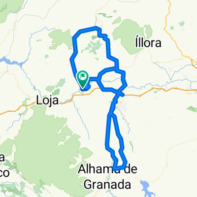
HUETOR TAJAR - ILLORA - ZUJAIRA - PINOS PUENTE - ATARFE - SANTA FE - CHAUCHINA (AV) - LACHAR - ESCOZNAR - ILLORA - TOCÓN (REAGRUPAMIENTO) - HUETOR TAJAR
- -:--
- Duration
- 92.1 km
- Distance
- 474 m
- Ascent
- 478 m
- Descent
- ---
- Avg. speed
- ---
- Max. altitude

Part of
AGOSTO 2018
4 stages
Route quality
Waytypes & surfaces along the route
Waytypes
Road
30.9 km
(34 %)
Busy road
26.4 km
(29 %)
Surfaces
Paved
62.3 km
(68 %)
Unpaved
1.7 km
(2 %)
Asphalt
62 km
(67 %)
Unpaved (undefined)
1.2 km
(1 %)
Continue with Bikemap
Use, edit, or download this cycling route
You would like to ride SALIDA 5 AGOSTO 2018 or customize it for your own trip? Here is what you can do with this Bikemap route:
Free features
- Save this route as favorite or in collections
- Copy & plan your own version of this route
- Split it into stages to create a multi-day tour
- Sync your route with Garmin or Wahoo
Premium features
Free trial for 3 days, or one-time payment. More about Bikemap Premium.
- Navigate this route on iOS & Android
- Export a GPX / KML file of this route
- Create your custom printout (try it for free)
- Download this route for offline navigation
Discover more Premium features.
Get Bikemap PremiumFrom our community
Other popular routes starting in Huétor-Tájar
 XXI MARCHA CICLOTURISTA DE HUETOR TAJAR (OPCION 2)
- Distance
- 138.7 km
- Ascent
- 1,290 m
- Descent
- 1,288 m
- Location
- Huétor-Tájar, Andalusia, Spain
 XXI MARCHA CICLOTURISTA DE HUETOR TAJAR - RECORRIDO CORTO(oficial)
- Distance
- 77.5 km
- Ascent
- 784 m
- Descent
- 785 m
- Location
- Huétor-Tájar, Andalusia, Spain
 SALIDA 28 OCTUBRE 2018
- Distance
- 78.6 km
- Ascent
- 460 m
- Descent
- 464 m
- Location
- Huétor-Tájar, Andalusia, Spain
 Cicloturista Huetor Tájar 2014
- Distance
- 99.8 km
- Ascent
- 1,039 m
- Descent
- 1,039 m
- Location
- Huétor-Tájar, Andalusia, Spain
 SALIDA EN FASE 2 DESESCALADA - Ruta Corta
- Distance
- 95.5 km
- Ascent
- 645 m
- Descent
- 649 m
- Location
- Huétor-Tájar, Andalusia, Spain
 SALIDA 10 - 7 ABRIL 2019
- Distance
- 78.6 km
- Ascent
- 732 m
- Descent
- 738 m
- Location
- Huétor-Tájar, Andalusia, Spain
 SALIDA 1_2011
- Distance
- 73.6 km
- Ascent
- 499 m
- Descent
- 499 m
- Location
- Huétor-Tájar, Andalusia, Spain
 SALIDA 21 DE OCTUBRE 2018
- Distance
- 64.4 km
- Ascent
- 512 m
- Descent
- 511 m
- Location
- Huétor-Tájar, Andalusia, Spain
Open it in the app